Avondale East & West
Boundaries
Because of development in the middle of the original Avondale neighborhood, the City of Houston designated two Avondale Historic Districts: East and West.
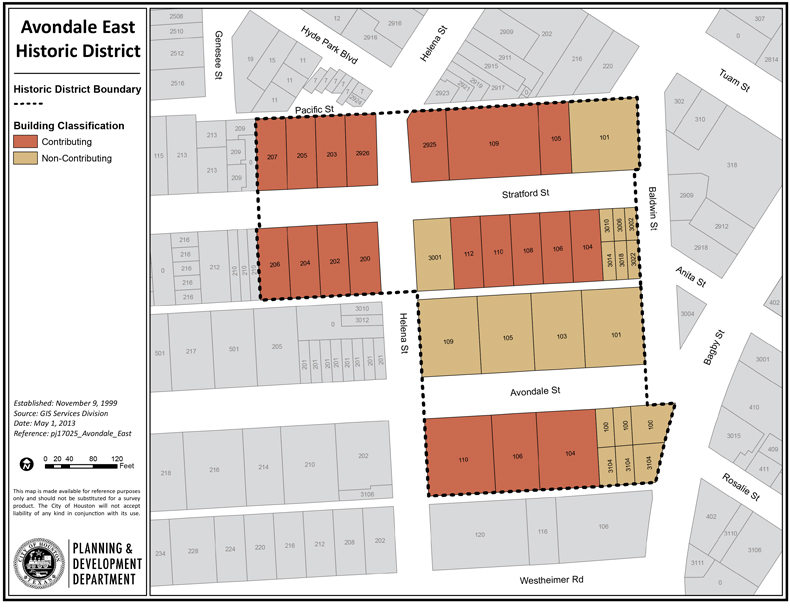
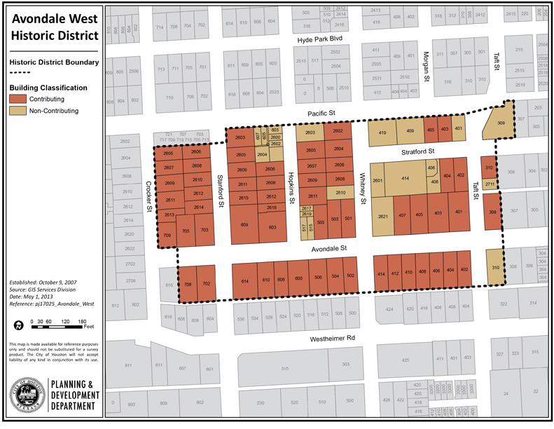
Avondale East Historic District includes the homes on either side of Avondale Avenue between Baldwin Street and Helena Street (the 100 block of Avondale), and the 100 block and half of the 200 block of Stratford Avenue. Avondale West Historic District is roughly bounded by Pacific Street, Taft Street, the alley that divides the block between Westheimer Road and Avondale Avenue, and Crocker Street.
The original Avondale Addition included homes on Stratford, Avondale, and Hathaway (Westheimer) Streets for three blocks between Baldwin and Taft. Later development extended the neighborhood for several additional blocks along all three streets, to Crocker Street.
Commercial development along Westheimer has erased that street’s original residential character. The houses that remain have been converted to retail stores and restaurants. As a result, Westheimer is not part of the historic district. About two blocks in the middle of the Avondale neighborhood also have been excluded, due to redevelopment. The rest of the original neighborhood has been designated as two separate historic districts: Avondale East and Avondale West.
Click the links below to download printable Map and Inventory.
- Avondale East Historic District Map
- Avondale East Historic District Inventory
- Avondale West Historic District Map
- Avondale West Historic District Inventory