Freeland
Boundaries
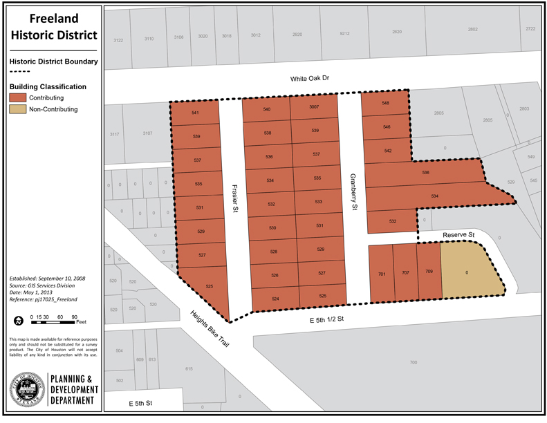
Freeland Historic District consists of 5 ¾ acres of land. It is located north of downtown Houston in the greater Heights area. It makes up part of the area bounded by Interstate Highway 10, Studemont/Studewood Street, Oxford Street, and White Oak Drive (East Sixth Street).
Specifically, the neighborhood is situated between East Sixth Street (White Oak Drive) to the north and East Fifth And A Half to the south, just east of Oxford Street.
Freeland’s plat is simple due to its small overall size. Properties line both sides of two narrow north-south streets (Frasier and Granberry) and one east-west street (East 5 ½). Lots are generally 50 x 100 feet, with a few exceptions – several lots on the east side of Granberry, which back up to a small ravine, are more than 200 feet deep.
Click links below to download printable classification map and inventory list.