Woodland Heights
Boundaries
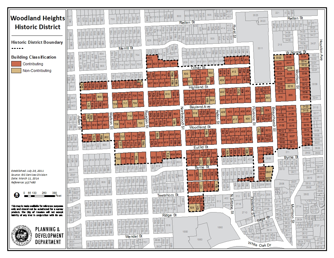
The Woodland Heights Historic District (which is slightly different than the general Woodland Heights neighborhood) includes the area within these boundaries: roughly Julian Street to the west; Omar Street to the north; Morrison Street to the east; and Byrne Street to the south.
The area within the Woodland Heights Historic District consists of a traditional grid of streets. The grid creates a series of regular, rectangular blocks. Each block was sized so that the lots within it could be 100 feet deep and between 50–75 feet wide. The original deed restrictions required a consistent setback of 20 feet from the street to the front of each house.
The Woodland Heights historical neighborhood boundaries have been described as the Bayland Orphanage and Klunkert farm properties to the west, Omar Avenue and the southern properties on Merrill to the north; Highland Park to the west; and White Oak Avenue (present day Byrne Street) to the south.
Click links below to download printable Map and Inventory list.