
 > Police >
POLICE Department
Crime Statistics for 11H50's Beat
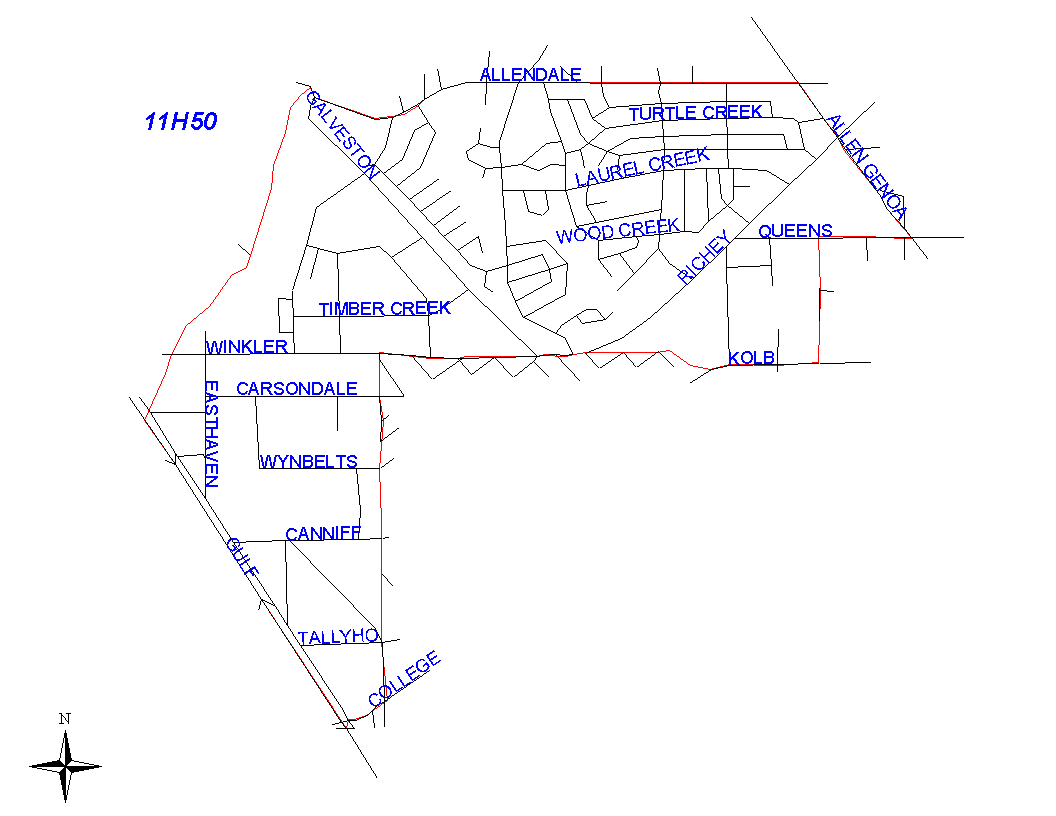
Click on map for larger, more detailed image
Beat Description and Boundary:
Beginning at the intersection of the Gulf Freeway and Berry Creek, the boundary goes northeast along the middle of Berry Creek east and south to Allendale Road. It then goes along the south lot lines of Allendale Road to the Houston City Limits that run along Allen-Genoa Road. The boundary follows the city limits that run along Allen-Genoa to Queens where the city limits turn west. It follows the city limits along Queens to Lepprechaun. The boundary then follows the city limits south along Lepprechaun to Kolb, then west along Kolb until it dead ends at Berry Gully. It follows Berry Gully to Allen and continues to follow the city limits west along Allen to South Galveston Road. When South Richey crosses to the west side of Old Galveston Road, south Richey changes to Winkler. The boundary continues east along the Houston city limits that parallel Winkler street to Canniff. The boundary turns south along the city limits that parallel Canniff to College. The boundary turns west along the south lot lines of College to the intersection of College and the Gulf Freeway. College is the responsibility of 11H50. It then turns northwest along the Gulf Freeway to the intersection of the Gulf Freeway and Berry Creek. The Gulf Freeway is the responsibility of 11H50.
Landmarks and Neighborhoods Within This Beat:
Meadow Creek, Ferndale Addition, Glenbrook Industrial
ZIP Codes Within This Beat (see note below on ZIP codes and beats):
77017
77502
77587