
 > Police >
POLICE Department
Crime Statistics for 5F40's Beat
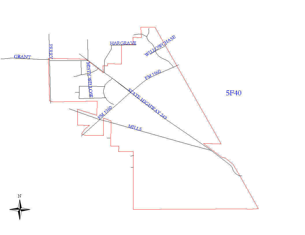
Click on map for larger, more detailed image
Beat Description and Boundary:
Beginning at a point where the city limits line intersects the CRIP Railroad tracks, just to the northeast of the dead end of the 13600 block of Ardfield, the boundary follows the city limits line southeast along the tracks to Greens Bayou. There, the boundary follows Greens Bayou in a west northwesterly direction until it intersects with Tomball Parkway. From there, the boundary then follows Tomball Parkway southeast to the point where Tomball Parkway intersects the CRIP Railroad tracks. There the boundary runs along the tracks southeast to the intersection of the tracks and Sam Houston Parkway North. Here, the boundary, still following the city limits line, runs due west to a point due south of the east lot lines of the Bellmeade Subdivision, turning due north to a point just north of Shoal Creek. Here, the boundary, still following the city limits line, turns west, north, west, and north again to a point on Mills Road just southeast of the 8600 block of FM 1960 West. Here the boundary runs along Mills Road to a point just southeast of FM 1960 West and then turns due west and then due north to Mills Road, crossing Mills Road, and then running east-southeast along Mills Road to a point approximately due south of Misty Willow. There, the boundary turns north-northeast to the south lot lines of the Willow Chase Park Subdivision. The boundary then follows the south lot lines of the Willow Chase Park Subdivision, west to Perry Road. The boundary then runs north along the eastern side of Perry Road's right of way to the intersection of Perry Road and Grant Road on the southeast corner, where it then runs east along the southern portion of Grant Road's right of way, to the intersection of Grant Road and Tomball Parkway (S.H. 249.) The west (odd) side of Perry road is Harris County, inclusive of roadway. The north (even) side of Grant Road is Harris County, inclusive of roadway. From the intersection of Grant Road and Tomball Parkway, the boundary runs southeast, still following the city limits line, to approximately the 18300 block of Tomball Parkway (S.H. 249.) At this point, the boundary follows the city limits line north, east, north, east, north, northeast, north, and, finally, east to the point where it began.
Landmarks and Neighborhoods Within This Beat:
Willowbrook, Willow Chase Park, Centerfield
ZIP Codes Within This Beat (see note below on ZIP codes and beats):
77064
77066
77069
77070