
 > Police >
POLICE Department
Crime Statistics for 6B10's Beat
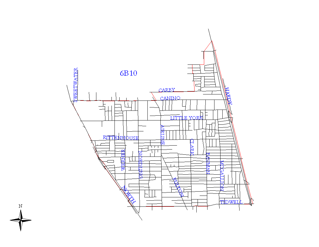
Click on map for larger, more detailed image
Beat Description and Boundary:
The boundary begins at the Houston city limits at about the intersection of Sweetwater and West Canino. It follows the city limits along West Canino east to Airline Drive. At Airline Drive, the city limits turn north and west to take in the Melrose Mud. The boundary continues to follow the city limits around the Mud to the Missouri Pacific Railroad Tracks. The boundary turns south along the railroad tracks and goes to Tidwell. At Tidwell, the boundary turns east along the south lot lines to I-45. Addresses north on both sides of Tidwell are the responsibility of 6B10. The boundary turns north on I-45 and goes to West Canino. It turns east on West Canino to the Houston City Limits at about the intersection of Sweetwater which is where it begins. I-45 is the responsibility of 6B10 from Tidwell to Little York.
Landmarks and Neighborhoods Within This Beat:
York Plaza, Pembrook Place, Hawthorne Place
ZIP Codes Within This Beat (see note below on ZIP codes and beats):
77022
77037
77076
77093