
 > Police >
POLICE Department
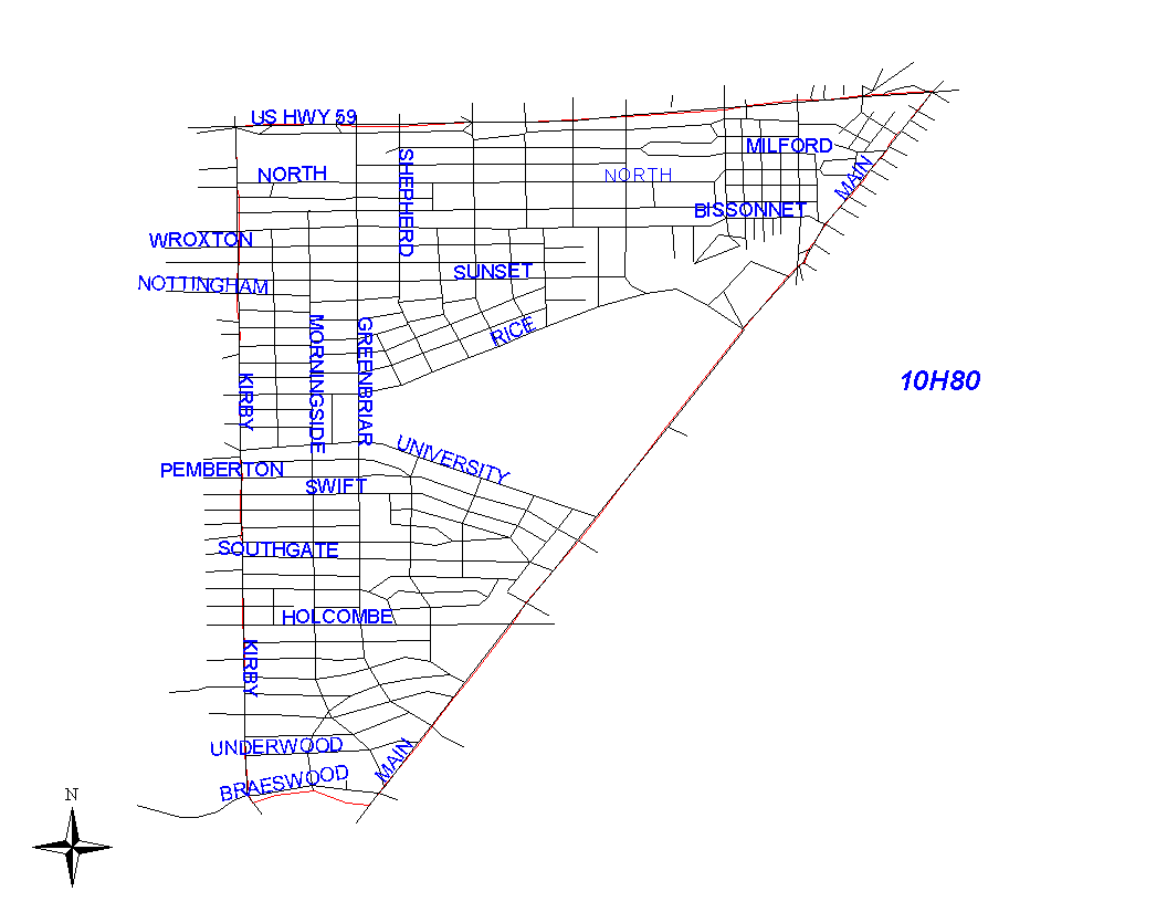
Crime Statistics for 10H80's Beat
Click on map for larger, more detailed image
Beat Description and Boundary:
The boundary begins at the intersection of the Southwest Freeway (I-59) and Kirby Drive and goes east on the Southwest Freeway to Main Street. The Southwest Freeway is in the jurisdiction of 1A30's beat. At Main, the boundary goes south to Brays Bayou. Main is the responsibility of 10H80. The boundary turns west at the Bayou and goes to the intersection of the Bayou and Kirby Drive. It turns north on Kirby Drive to the West University Place City Limits. Kirby Drive is the responsibility of 15E30. The beat boundary follows the east West University Place City Limits north and continues north on Kirby Drive to the Southwest Freeway where it begins. Between the West University Place City Limits and the Southwest Freeway, addresses on both sides of Kirby are in 1A50.
Landmarks and Neighborhoods Within This Beat:
Southampton, Rice University area, Shadow Lawn, Broad Acres
ZIP Codes Within This Beat (see note below on ZIP codes and beats):
77002
77004
77005
77006
77030
77098