
 > Police >
POLICE Department
Crime Statistics for 16E20's Beat
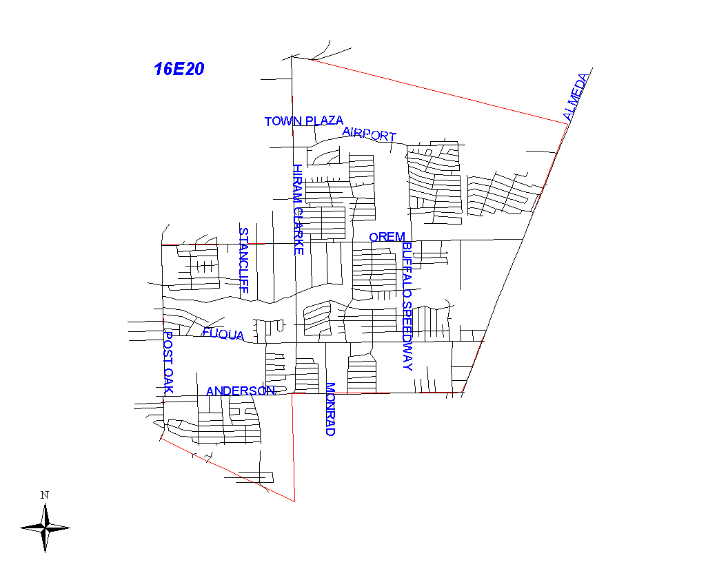
Click on map for larger, more detailed image
Beat Description and Boundary:
The boundary begins at the intersection of Hiram Clarke, South Main, and Holmes Road. There is an open space south of Holmes Road between Hiram Clarke and Almeda Road. The first street south of Holmes Road on Hiram Clarke is Uptown. There is a street called Clover Lane off of Almeda Road about two and one half miles south of Holmes Road, or one and a half miles south of Reed Road. The beat boundary goes east across the open space from the intersection of Hiram Clarke, South Main, and Holmes to Almeda Road. The point of intersection on Almeda Road is about one half mile north of Clover Lane and the interseciton of the end of Airport Boulevard at the South Freeway to the intersection of Hiram Clarke, South Main and Holmes Road. At Almeda Road, the beat boundary turns south along the west lot lines of Almeda Road to the Houston city limits at Anderson Road. Almeda Road is the responsibility of 16E10's beat. The beat boundary follows the city limits west along Anderson Road to Hiram Clarke. At that intersection, both boundaries turn south to the South Beltway 8. The city limits continue south while the beat boundary turns northwest along the Fort Bend County line that follows the Beltway to South Post Oak. The beat boundary turns north along the east lot lines of South post Oak to West Orem. It turns east along the south lot lines of West Orem to Hiram Clarke. The boundary turns north along the west lot lines of Hiram Clarke to the intersection of Hiram Clarke, South Main, and Holmes Road, which it where it begins.
Landmarks and Neighborhoods Within This Beat:
Almeda Plaza, South Glen, Dumbarton Oaks, Briarwick
ZIP Codes Within This Beat (see note below on ZIP codes and beats):
77045
77053