
 > Police >
POLICE Department
Crime Statistics for 1A30's Beat
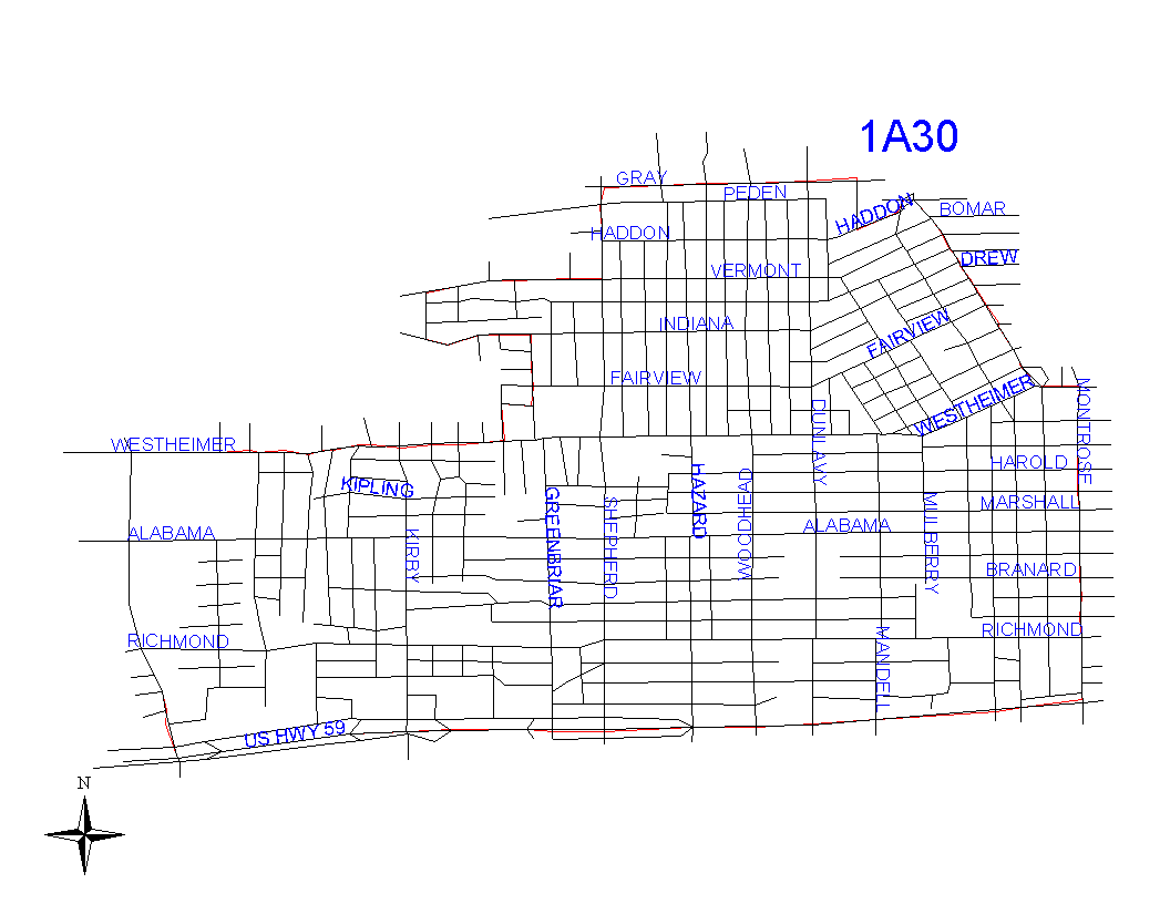
Click on map for larger, more detailed image
Beat Description and Boundary:
The boundary begins at South Shepherd
and West Gray and goes east long the south side of West Gray to
Metropolitan. West Gray is in the jurisdiction of 1A20. the boundary
follows Metropolitan south for one block and turns northeast on
Hadden to Waugh. Both Metropolitan and Haden are the responsibility
of 1A30. The boundary goes southeast on the southwest lot lines
of Waugh to Westheimer and follows the south lot lines of Westheimer
east for about one block to Montrose. Neither Waugh nor Westheimer
are the responsibility of 1A30, but are in the 1A20's beat. The
boundary goes south along the west lot lines of Montrose to the
Southwest Freeway (Highway 59). It follows the Southwest Freeway
to the east lot lines along the Buffalo Speedway. the Southwest
Freeway is in the jurisdiction of 1A30. The boundary turns north
along the east lot lines of Buffalo Speedway to Westheimer. Much
of this area is open space. The addresses on both sides of Buffalo
Speedway are in 1A50's beat. the boundary goes east along the
south lot lines of Westheimer (which belongs to 1A40's beat) to
Dunraven, turns east along the south lot lines of Dunraven (which
belongs to 1A40's beat) to Kingston, turns north on the east lot
lines of Kingston (which belongs to 1A40) to Indiana, turns west
to the north lot lines of Indiana (which belongs to 1A40) to Argonne,
north on east lot lies of Argonne (which belongs to 1A40), and
follows Argonne to San Felipe. It goes east on the north lot lines
of San Felipe to South Shepherd. San Felipe is the responsibility
of 1A30. At the intersection with South Shepherd, the boundary
turns north along the west lot lines of South Shepherd to West
Gray, where the boundary begins. South Shepherd is the responsibility
of 1A30.
Landmarks and Neighborhoods Within This Beat:
Cherryhurst, Mandell Place, Montrose
ZIP Codes Within This Beat (see note below on ZIP codes and beats):
77006
77019
77098