Audubon Place
Boundaries
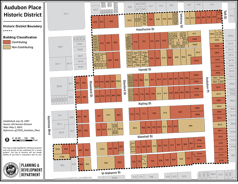
The Audubon Place Historic District is bounded roughly by Hawthorne Street to the north, Audubon Place to the east, West Alabama Street to the south, and Montrose Boulevard to the west. Other streets within the district are Hawthorne, Harold, Kipling, Marshall, Stanford, Roseland, and Whitney. The same boundaries are used by the Audubon Place Civic Association.
In the original plat of the neighborhood, some of the streets had different names than they do now. Roseland Street was “Terry,” and Stanford Street was “Conner.” Marshall Street was called “Oxford.” West Alabama Street (and its name) eventually overtook other streets along the same route, including Mound Street, West Milam Road, and Ross Street.
Click links below to download printable classification map and inventory list.