Glenbrook Valley
Boundaries
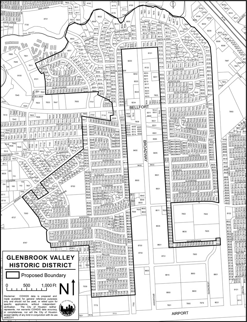
The Glenbrook Valley Historic District is located near Hobby Airport in Southwest Houston. Bellfort Avenue and Broadway Street cross in the middle of the neighborhood. It lies between Sims Bayou to the north and Hobby Airport to the south. Its east and west boundaries are the Gulf Freeway (IH-45) and Telephone Road.
Glenbrook Valley was planned in 13 sections. That plan is part of what makes the neighborhood significant. The Historic District includes the entire neighborhood.
Glenbrook Valley is organized around the intersection of Bellfort Avenue and Broadway Street. Broadway is the north-south axis, and Bellfort runs east-west. Broadway is lined with commercial buildings. The residential neighborhood surrounds the commercial core on both sides of Broadway, from Airport Road in the south all the way north to Sims Bayou.
South of Bellfort Avenue, the neighborhood is laid out in a very regular, mostly rectangular fashion. Most of those lots are about the same size. Many of them are oriented north-south. Many of the blocks in this part of the neighborhood are about the same size, too.
The neighborhood is different north of Bellfort Avenue. Closer to the Bayou, the lots are less regularly shaped and sized. More of them are oriented east-west. Streets are also more winding and create blocks of varying shapes and sizes. Hare and Hare did that to take advantage of the natural terrain around the Bayou.
Click links below to download printable classification map and inventory list.