Norhill
Boundaries
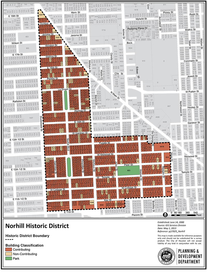
The Norhill Historic District is an L-shaped area. The district is bounded by Studewood to the west. The base of the L is contained within Key and Pecore Streets to the south, Moss Street to the east, and Fugate Street to the north. The stem of the L is comprised to the east by Michaux Street, and at an angle, North Main Street.
The greater Norhill area is located on former pastureland north of downtown Houston. It was developed in sections. The Norhill Historic District includes two of those sections: North Norhill and East Norhill.
North Norhill was a 95.58-acre tract of land, divided into 555 lots. The boundaries included Studewood to the east, North Main Street to the north, Michaux Street to the east, and 11th and Pecore Streets to the south.
East Norhill contained 292 lots. Its boundaries were Michaux Street to the west, the north side of Fugate Street to the north, and Moss Street to the east. Its southern boundary included the north side of Key Street to approximately Julian Street, and the south side of Key from Julian to Michaux.
Click links below to download printable classification map and inventory list.