Westmoreland
Boundaries
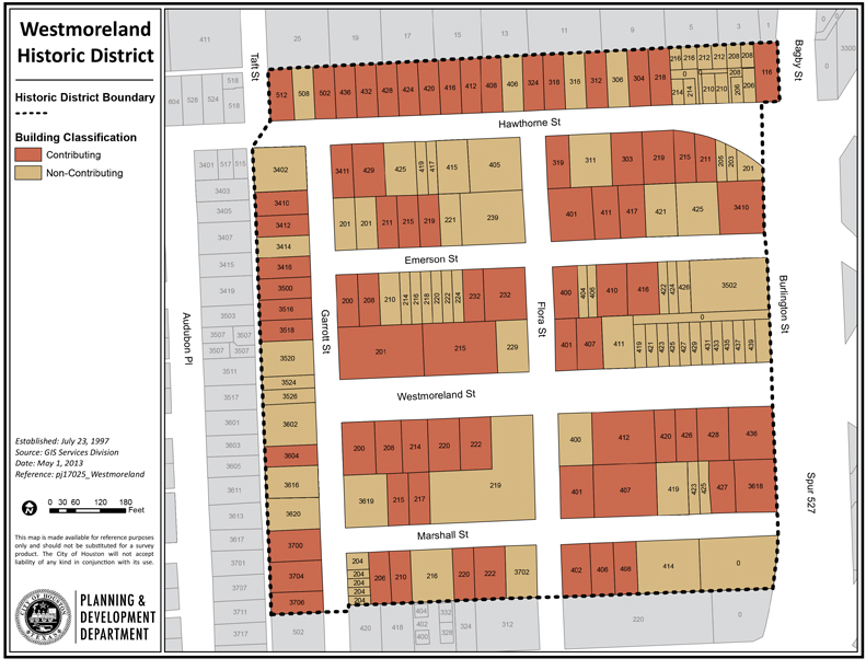
The Westmoreland Historic District includes most of the original Westmoreland Addition. The historic district’s boundaries include the rear property lines on the north side of Hawthorne Street, the south side of Marshall Street, and the west side of Garrott Street. Spur 527 makes up the eastern boundary of the district.
Westmoreland was originally platted as a twelve-block addition on 44 acres. The historic district includes six full blocks, two partial blocks, and two partial long blocks. Streets run north-south (Garrott, Flora, and Burlington Streets) and east-west (Hawthorne, Emerson, Westmoreland, and Marshall Streets).
Click links below to download printable Map and Inventory list.