
 > Police >
POLICE Department
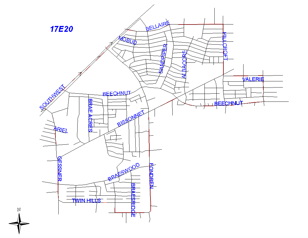
Crime Statistics for 17E20's Beat
Click on map for larger, more detailed image
Beat Description and Boundary:
The boundary begins at the intersection of the Southwest Freeway (I-59) and Bellaire Boulevard and goes east along the south lot lines of Bellaire Boulevard to Hillcroft. It turns south along the west lot lines of Hillcroft to Pine. It turns east along the north lot lines of Pine to the Bellaire City Limits that follows Renwick. It turns south along the Bellaire City Limits and goes to Maple. At Maple, the Bellaire City Limits turn east while the beat boundary continues south along the east lot lines of Renwick to Beechnut. It turns west along the north lot lines of Beechnut to Bissonnet. It turns southwest along the southeast lot lines of Bissonnet to Fondren. The boundary goes south along the east lot lines of Fondren to Creekbend. It then turns west along the north lot lines of Creekbend and goes to Valley Hills. The beat boundary turns north along the east lot lines of Valley Hills and goes to Twin Hills. The boundary continues west along the south lot lines of Twin Hills and goes to South Gessner. It turns north along the east lot lines of South Gessner to the Southwest Freeway. It turns northeast along the south side of the Southwest Freeway and goes to the intersection with Bellaire Boulevard, which is where it begins.
Landmarks and Neighborhoods Within This Beat:
Houston Baptist University area, Maplewood West
ZIP Codes Within This Beat (see note below on ZIP codes and beats):
77071
77074
77081
77096
77401