
 > Police >
POLICE Department
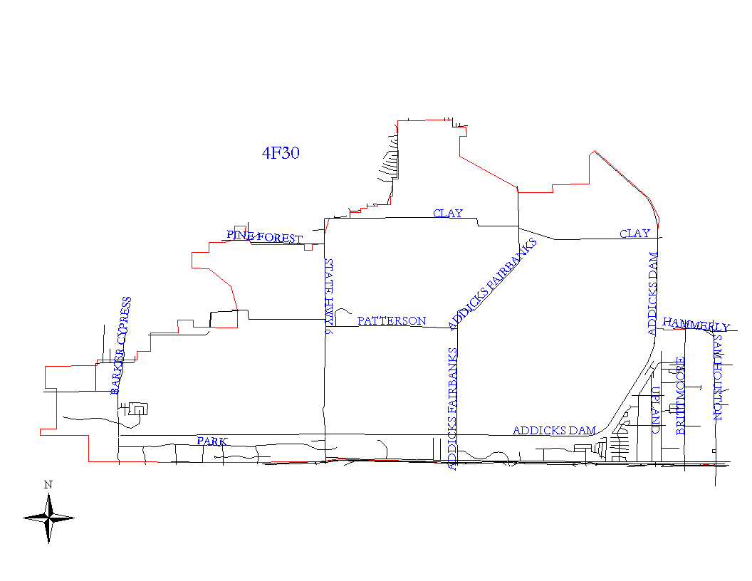
Crime Statistics for 4F30's Beat
Click on map for larger, more detailed image
Beat Description and Boundary:
The boundary begins at the intersection of the U. S. Government Service Road and Hammerly and goes east on Hammerly to the proposed West Belt. Hammerly is the responsibility of 4F20. The boundary turns south on the proposed West Belt to a point straight west of the south lot lines of the Tiber Oaks Subdivision. The Proposed West Belt is the responsibility of 4F10. The boundary turns east from this point straight east and continues along the lot lines to Stebbins. It turns south on Stebbins, jogs west on Haddinton, and continues south on Stebbins Circle and Townhurst to the north lot lines of Hazelhurst. The boundary turns west, south, and back east around the lot lines of the Spring Lea Subdivision to Lumpkin Road. The boundary turns south on Lumpkin Road and goes to the katy Freeway. Stebbins, Haddinton, Stebbins Circle, Townhurst, Hazelhurst, and Lumpkin Road are the responsibility of 4F10. The boundary turns west along the M.K.T. Railroad tracks just north of the Katy Freeway to the city limits. The boundary follows the city limits north to the Addicks Reservior and goes all the way around the Addicks Reservior to hammerly, which is where it begins. Although this beat encompasses the entire Addicks Reservior, the activities of officers will be concentrated on the area west and south of the U. S. Government Service on the east side of the reservior.
Landmarks and Neighborhoods Within This Beat:
Addicks Reservoir Area, Claymore Park, Brittmore Village, Park Ten Place, Mayde Creek Farms
ZIP Codes Within This Beat (see note below on ZIP codes and beats):
77024
77041
77043
77079
77084
77094