
 > Police >
POLICE Department
Crime Statistics for 5F30's Beat
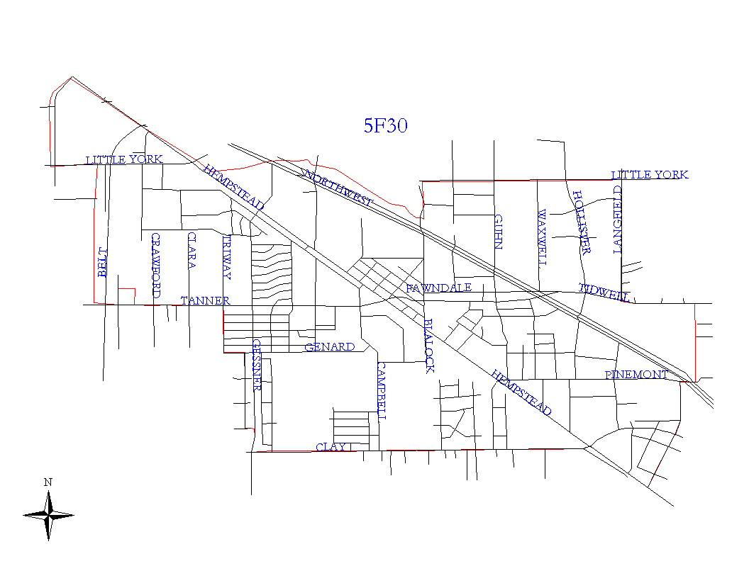
Click on map for larger, more detailed image
Beat Description and Boundary:
The boundary begins at the city limits intersection at Hempstead Road and Cole Creek and goes east following the city limits along Cole Creekkk to Fairbanks Houston Road where it follows the city limits north along this road to West Little York. At West Little York, the beat boundary follows the city limits east. The city limits turn northand the beat boundary continues east on West Little York to the intersection of West Little York and Langfield. At Langfield, the beat boundary turns south to West Tidwell, turns east on West Tidwell and turns south off of West Tidwell at Burroak. It continues south on Burroak to Pinemont, and jogs west on Pinemont to Southerland and goes southwest on Southerland to Hempstead Highway. West Little York from Langfield to Twisting Vine, Langfield, West Tidwell, Burroak, Pinemont, and Southerland are the responsibility of the North Shepherd Substation. The boundary turns northwest along Hempstead to the intersection with Clay Road. Hempstead Highway is the responsibility of 5F30. The boundary turns west on Clay Road to the city limits. Clay Road is the responsibility of 5F30. The beat boundary follows the city limits as they turn north along Gessner to Hempstead and then northwest on Hempstead to Cole Creek where it begins.
Landmarks and Neighborhoods Within This Beat:
Fairbanks, Carverdale, Fawndale, Northwest Crossing
ZIP Codes Within This Beat (see note below on ZIP codes and beats):
77040
77041
77080
77092