
 > Police >
POLICE Department
Crime Statistics for 7C50's Beat
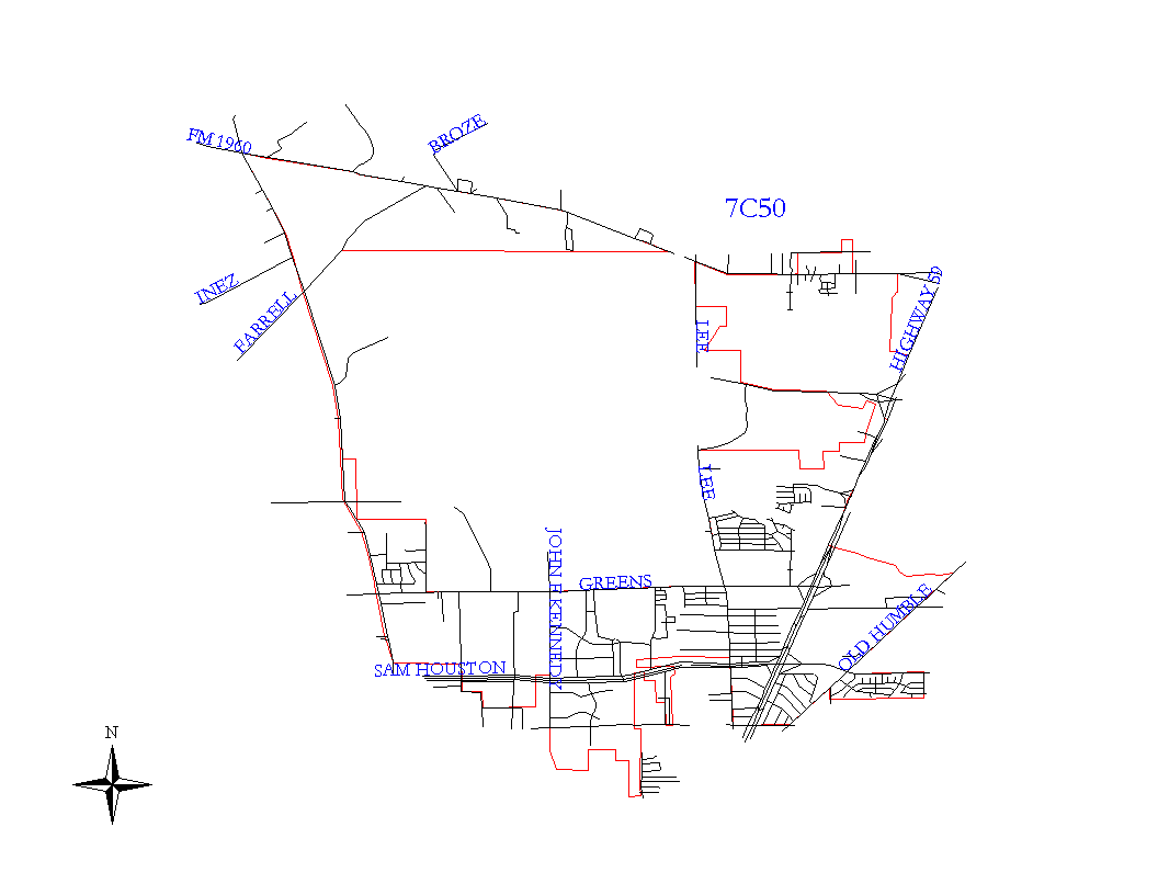
Click on map for larger, more detailed image
Beat Description and Boundary:
The boundary begins at the Houston City Limits at the intersection of Aldine-Westfield and Humble Westfield and follows the city limits east on Humble-Westfield until the city limits turn north about one-quarter mile east of Carver Street. The boundaries go to Spring Creek. The beat boundary goes east along the creek until it intersects with the city limits and turns south. The boundaries go south to Humble-Westfield and turn east. About a quarter mile east of Hightower, the boundaries turn south and go to Highway 59 and continue southwest along 69 to Garmen Bayou. They turn east along the bayou to Atascocita and Old Humble Road. They turn southwest along Old Humble Road to the Proposed North Belt. They go around the Eastex Oaks Subdivision and continue southwest along Old Humble Road to Aldine Bender. They go west on Aldine Bender to Lee Road, north on Lee Road to the North Beltway 8. About a quarter mile west of JFK Boulevard, the boundaries turn south to Finsbury, then west on Finsbury to Morales, north on Morales to the Beltway, and west on the Beltway to Aldine-Westfield Road. It turns north on Aldine-Westfield Road to the intersection of Aldine-Westfield Road and Humble Westfield Road, which is where it begins.
The Intercontinental Airport is in the jurisdiction of 21I50.
Landmarks and Neighborhoods Within This Beat:
Northwood, Lakeview Park, Glen Lee
ZIP Codes Within This Beat (see note below on ZIP codes and beats):
77032
77060
77073
77338
77396