
 > Police >
POLICE Department
Crime Statistics for 9C20's Beat
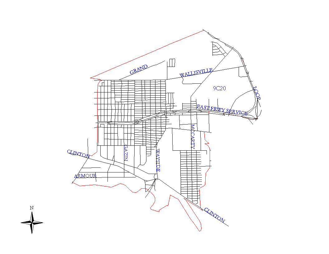
Click on map for larger, more detailed image
Beat Description and Boundary:
The boundary begins at the southwest end of the Englewood Railroad Yard where the SPRR railroad tracks cross the other tracks in the railroad yard. The boundary goes northeast along the SPRR railroad that runs parallel to Liberty Road and goes to the 610 Loop. The 610 Loop is the responsibility of 9C30. The Englewood Railroad Yard is in the jurisdiction of 9C20. The boundary turns southeast along the 610 Loop and goes to the East Freeway (I-10.) I-10 from the 610 Loop to Aleen is the responsibility of 9C20. It turns west along the East Freeway and goes to Aleen. The boundary turns south along the east side of Aleen until it intercepts railroad tracks. It continues south along the railroad tracks as they run along the west lot lines of Pleasant Ville Subdivision. The tracks turn southwest across the clearing to the west lot lines of Port Houston. The tracks go south along the ends of these dead end streets to Filmore. The beat boundary follows these tracks until they end. The beat boundary then continues in a straight line from the tracks along the dead end streets to Clinton Drive. On the southwest side of Clinton Drive, there is a grain elevator. The beat boundary goes around the grain elevator to the wharfs and intersects the Ship Channel at about wharfs 15 and 16. The boundary turns west along the Ship Channel and Buffalo Bayou to Lockwood. It turns north on the east side of Lockwood and goes to the SPRR railroad tracks. The boundary follows the SPRR railroad tracks to the Englewood Railroad Yard, which is where it begins.
Landmarks and Neighborhoods Within This Beat:
Denver Harbor, Houston Harbor
ZIP Codes Within This Beat (see note below on ZIP codes and beats):
77011
77012
77020
77028
77029