
 > Police >
POLICE Department
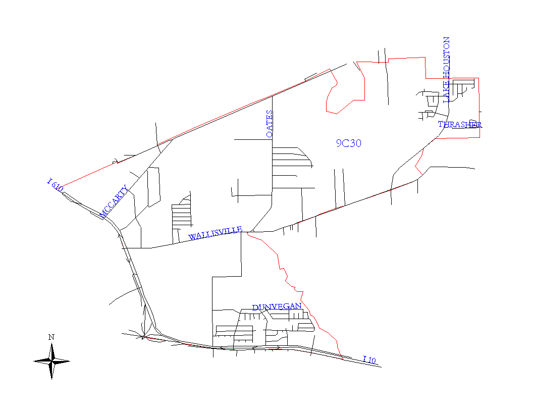
Crime Statistics for 9C30's Beat
Click on map for larger, more detailed image
Beat Description and Boundary:
The boundary begins at the intersection of the 610 Loop and the SPRR railroad that runs parallel with Liberty Road and follows the SPRR railroad tracks northeast to the Houston city limits. It follows the city limits as they turn south along Greens Bayou to the HP&L Greens Bayou Station. The boundary follows the city limits around the HP&L property and continues along the bayou to Wallisville Road. The beat boundary turns west along the south lot lines of Wallisville Road to Hunting Bayou. It turns south along Hunting Bayou to the San Jacinto city limits on the south side of the East Freeway (I-10.) The East Freeway is the responsibility of 9C30. The beat boundary follows the city limits west for about one on one-half miles where the city limits turn south. At that point, the beat boundary continues west along the East Freeway to the 610 Loop. The 610 Loop is the responsibility of 9C30. It turns north, northwest, and west along the Loop until it crosses the SPRR railroad, which is where it begins.
Landmarks and Neighborhoods Within This Beat:
City Park East, Wynnewood Acres, Wallisville Gardens
ZIP Codes Within This Beat (see note below on ZIP codes and beats):
77013
77029
77044
77049
77078