
 > Police >
POLICE Department
Crime Statistics for South Central Patrol Division
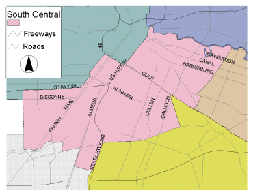
Estimated Population: 96,108
Approximate Square Miles: 18.4
10H10
Approximate street boundaries:
North: Buffalo Bayou
East: HB&T RR Track
South: MKTMP RR Track
West: MKTMP RR Track
Landmarks/Neighborhoods: Oak Lawn, Ranger
Click here for a detailed text description
of the boundaries of this beat.
Click here for a detailed map of this beat.
10H20
Approximate street boundaries:
North: MKTMP RR Track
East: HB&T RR Track
South: I-45 Gulf Fwy
West: Sampson
Landmarks/Neighborhoods: Eastwood, Broadmoor
Click here for a detailed text description
of the boundaries of this beat.
Click here for a detailed map of this beat.
10H30
Approximate street boundaries:
North: Hwy 59 Eastex Fwy
East: MKTMP RR Track
South: I-45 Gulf Fwy
West: Hwy 59 Eastex Fwy
Landmarks/Neighborhoods: Near East End
Click here for a detailed text description
of the boundaries of this beat.
Click here for a detailed map of this beat.
10H40
Approximate street boundaries:
North: I-45
East: Hwy 59
South: Hwy 59
West: Spur 527
Landmarks/Neighborhoods: Midtown
Click here for a detailed text description
of the boundaries of this beat.
Click here for a detailed map of this beat.
10H50
Approximate street boundaries:
North: I-45
East: HB&T RR Track
South: Wheeler to Cleburne
West: Hwy 288
Landmarks/Neighborhoods: University of Houston area
Click here for a detailed text description
of the boundaries of this beat.
Click here for a detailed map of this beat.
10H60
Approximate street boundaries:
North: Cleburne to Wheeler
East: HB&T RR Track
South: Old Spanish Trail
West: Hwy 288
Landmarks/Neighborhoods: University Oaks, Riverside Terrace, Texas
Southern University area
Click here for a detailed text description
of the boundaries of this beat.
Click here for a detailed map of this beat.
10H70
Approximate street boundaries:
North: Hwy 59
East: Hwy 288
South: El Camino to Old Spanish Trail
West: South Main
Landmarks/Neighborhoods: Texas Medical Center, Hermann Park, Houston
Zoo, Miller Outdoor Theatre
Click here for a detailed text description
of the boundaries of this beat.
Click here for a detailed map of this beat.
10H80
Approximate street boundaries:
North: Hwy 59
East: South Main
South: Braeswood
West: Kirby
Landmarks/Neighborhoods: Southampton, Rice University area, Shadow
Lawn, Broad Acres
Click here for a detailed text description
of the boundaries of this beat.
Click here for a detailed map of this beat.
Notes:
- The Houston Police Department does not recommend raw data comparisons be made between police beats. This web site does not provide a comparative analysis of the various beats.
- If you plan to print out the crime statistic tables, for best results, choose the "landscape" orientation from the properties menu in your printer dialogue box.
- ZIP code boundaries and police beat boundaries do not correspond. ZIP code boundaries may overlap beat boundaries and there may be several beats within several ZIP codes and vice versa. ZIP codes are provided only as a reference.
- PLEASE NOTE: In accordance with the national shift in crime data collection and reporting methods, the Houston Police Department is currently transitioning from UCR to NIBRS ahead of the FBI’s 2021 deadline. The publication of summary crime data and departmental reports has been delayed due to this transition. Crime data for June 2018 and the months following will be provided as soon as the department is granted state certification under the NIBRS data collection method.