
 > Police >
POLICE Department
Crime Statistics for Southwest Patrol Division
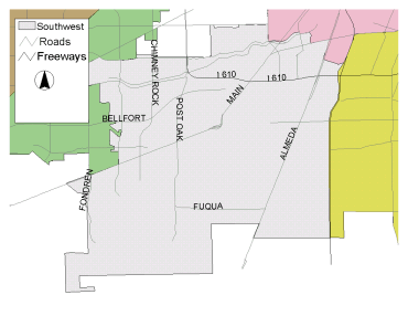
Estimated Population: 217,443
Approximate Square Miles: 52.2
15E10
Approximate street boundaries:
North: Beechnut
East: 610 West Loop South
South: Willowbend
West: Bob White to Marinette
Landmarks/Neighborhoods: Meyerland Plaza, Robindell, Meyerland,
Braeburn Terrace, Maplewood South
Click here for a detailed text description
of the boundaries of this beat.
Click here for a detailed map of this beat.
15E20
Approximate street boundaries:
North: Willow Bend
East: South Post Oak
South: South Main
West: West of Hillcroft
Landmarks/Neighborhoods: Westbury, Park West, Willow Creek
Click here for a detailed text description
of the boundaries of this beat.
Click here for a detailed map of this beat.
15E30
Approximate street boundaries:
North: Bellaire
East: South Main
South: South Main
West: South Post Oak
Landmarks/Neighborhoods: Meyer Park, Post Oak Manor, Westwood,
Willow Bend, Linkwood
Click here for a detailed text description
of the boundaries of this beat.
Click here for a detailed map of this beat.
15E40
Approximate street boundaries:
North: N. Braeswood
East: Almeda to Hwy 288
South: Reed Road
West: South Main
Landmarks/Neighborhoods: The Astrodome, Six Flags Astroworld,
Lakes at 610, Plaza del Oro
Click here for a detailed text description
of the boundaries of this beat.
Click here for a detailed map of this beat.
16E10
Approximate street boundaries:
North: Airport Blvd
East: Hwy 288
South: South Sam Houston Pkwy
West: Almeda
Landmarks/Neighborhoods: Canterbury Village, Monarch Estates
Click here for a detailed text description
of the boundaries of this beat.
Click here for a detailed map of this beat.
16E20
Approximate street boundaries:
North: W. Orem to W. Airport
East: Almeda
South: South Sam Houston Pkwy
West: South Post Oak
Landmarks/Neighborhoods: Almeda Plaza, South Glen, Dumbarton Oaks,
Briarwick
Click here for a detailed text description
of the boundaries of this beat.
Click here for a detailed map of this beat.
16E30
Approximate street boundaries:
North: South Main
East: Hiram Clarke
South: South Sam Houston Pkwy
West: South Sam Houston Pkwy
Landmarks/Neighborhoods: Greenpark, Southwest Crossing, Windsor
Village
Click here for a detailed text description
of the boundaries of this beat.
Click here for a detailed map of this beat.
16E40
Approximate street boundaries:
North: Fondren to Settemont
East: South Sam Houston Pkwy
South: Hiram Clarke
West: McHard
Landmarks/Neighborhoods: Chasewood, Willowpark, Briarwick, Ridgemont,
Quail Run
Click here for a detailed text description
of the boundaries of this beat.
Click here for a detailed map of this beat.