Fostering Complete Communities

2017 Annual Report
2017 Annual Report

By all accounts, 2017 was an incredible year for Houston. Our Astros won the World Series, Super Bowl LI highlighted our hospitality, and Hurricane Harvey showed the world what Houston Strong means. Mayor Sylvester Turner was able to secure bipartisan pension reform and one writer (from Dallas, no less!) suggested he should be Texan of the Year for his efforts after Harvey.
As this report shows, the Planning and Development Department also had a big year largely focused around five big projects. The Houston Bike Plan was adopted by City Council on March 22, 2017 and planning for implementation of bike plan recommendations is underway. The newly drafted Houston Heights Historic District Design Guidelines were approved by the Houston Archaeological and Historical Commission on December 13, 2017 and will be presented to City Council in 2018. The Department launched a new project to address walkability and undertook a project to radically reimagine the Lower Westheimer corridor with our partners in Houston Public Works. Complete Communities, Mayor Turner's ambitious effort to transform underserved communities, kicked off an extensive public engagement and neighborhood planning process. And Planning Department employees responded to Mayor Turner’s call to assist Houstonians affected by Harvey by volunteering over 300 hours at the George R. Brown Convention Center, Toyota Center, other shelters or in their very own neighborhoods! All of this was on top of our regular regulatory workload and many other important projects.
I would like to acknowledge and thank the department’s outstanding employees for their service to the Houston community. The approximately 85 individuals are extremely dedicated public servants and I am proud to be part of such a talented and diverse team. I invite you to join us as we strive toward a more vibrant and livable Houston.
Sincerely,

Patrick Walsh, Director
While the Planning and Development Department (P&D) has many important initiatives, we’d like to highlight five critical projects that are underway and shaping Houston’s future. These projects present an opportunity to foster more complete communities and create vibrant, walkable places that are well-connected to jobs, parks, activity centers, and recreational options.
Heights Historic Districts Design Guidelines
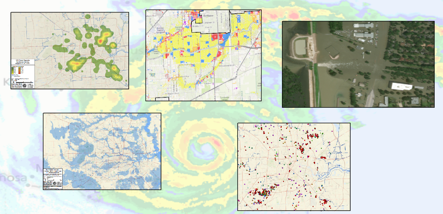
A mosaic of maps created by the P&D GIS Team related to Hurricane Harvey
GIS Maps out Harvey Disaster Response
During Hurricane Harvey, six Geographic Information System (GIS) employees from P&D remained at the forefront of City emergency operations and served as a vital emergency response resource.
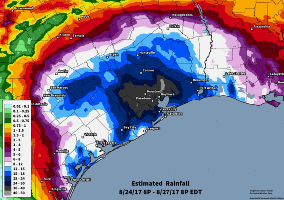

LEFT: Total rainfall for the worst of the storm. Source- Weather blogger Paul Douglas RIGHT: Hurricane Harvey’s track to the Gulf Coast
The team’s significant mapping capabilities were relied upon heavily by government officials and first responders including the Houston Police and Fire Departments, Mayor Sylvester Turner, Harris County Judge Ed Emmett, and other agencies to formulate and coordinate emergency action plans and rescues throughout the Houston-Galveston area.
The GIS team was stationed at the Houston Emergency Center (HEC) for several days, before and after Hurricane Harvey. One staff member was stationed at the HEC for six straight days! Their dedication to provide crucial mapping services around the clock benefited Houston area emergency efforts and countless of citizens. We tip our hats to GIS and the invaluable service they provide!
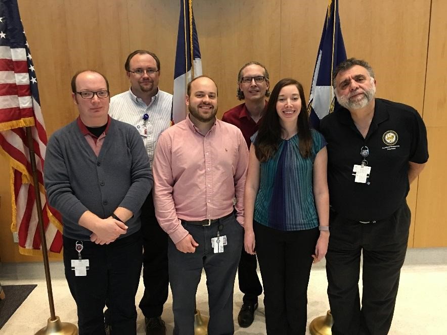

LEFT: GIS team, top row (left to right): GIS Manager Larry Nierth and Joel Avery. Bottom row (left to right): Braniff Davis, Zach Oyer, Laura Waddle, and Joel Casas RIGHT: Larry Nierth at the HEC with emergency officials.
The Department plays a significant role in supporting and preserving Houston’s neighborhoods and strengthening the community through civic engagement and plan development. P&D helps communities maintain the character of their area through various neighborhood programs like Historic Preservation, Minimum Lot Size/Building Line, and the Prohibited Yard Parking. These programs require applications initiated by the local community. The Department was also charged in 2017 with leading the Complete Communities Initiative, Mayor Turner’s signature program for improving quality of life in areas that are not thriving at a level enjoyed by other Houston neighborhoods.
Complete Communities
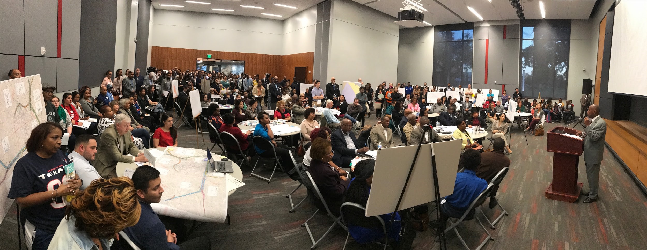
![]() Mayor Turner announced the beginning of a new initiative on April 17, 2017 – Complete Communities. Complete Communities is about improving neighborhoods so that all of Houston’s residents and business owners can have access to quality services and amenities. It’s about working closely with the residents of communities that haven’t reached their full potential, understanding their strengths and opportunities, and collaborating with partners across the city to strengthen them. The objective is to improve these communities while retaining affordable housing options so that existing residents can stay in their neighborhood.
Mayor Turner announced the beginning of a new initiative on April 17, 2017 – Complete Communities. Complete Communities is about improving neighborhoods so that all of Houston’s residents and business owners can have access to quality services and amenities. It’s about working closely with the residents of communities that haven’t reached their full potential, understanding their strengths and opportunities, and collaborating with partners across the city to strengthen them. The objective is to improve these communities while retaining affordable housing options so that existing residents can stay in their neighborhood.
Pilot Neighborhoods
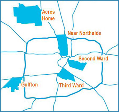 The Mayor selected five pilot areas for the Complete
Communities Program: Acres Home, Gulfton, Near Northside, Second Ward and Third Ward. Diverse neighborhoods were selected with various conditions and challenges. No two communities are the same. Common elements between them are they are all historically under-resourced and each has a base level of community involvement and support, diverse populations, and its own unique look and feel. The action plans developed for each of the pilot neighborhoods will identify a vision, goals and actions to address community priorities. The goal is that these pilot neighborhoods will serve as practical examples for expansion of locally based initiatives to many other City areas.
The Mayor selected five pilot areas for the Complete
Communities Program: Acres Home, Gulfton, Near Northside, Second Ward and Third Ward. Diverse neighborhoods were selected with various conditions and challenges. No two communities are the same. Common elements between them are they are all historically under-resourced and each has a base level of community involvement and support, diverse populations, and its own unique look and feel. The action plans developed for each of the pilot neighborhoods will identify a vision, goals and actions to address community priorities. The goal is that these pilot neighborhoods will serve as practical examples for expansion of locally based initiatives to many other City areas.
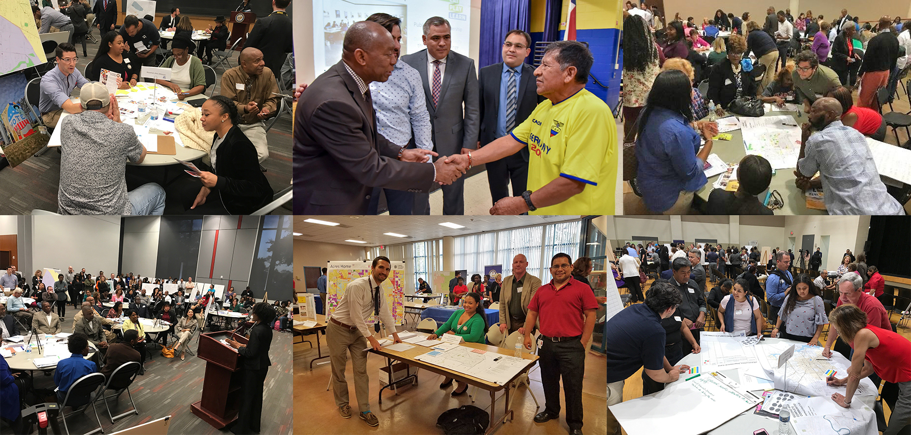
Community Outreach
The Department is working with community stakeholders and residents to develop Action Plans in each of the five pilot neighborhoods. The Plans are community-driven, derived from substantial community input and identify visions, goals and actions to address community priorities. In
communities where existing planning efforts through a community-driven process exist, their goals and actions serve as the base of the Action Plan. Citizens attended more than 200 meetings including informal small group (coffee klatch), one-on-one, various organizations, neighborhood
events, Super Neighborhood, and Neighborhood Support Team meetings.
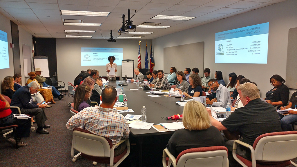
Department Meetings
An attribute of the Complete Communities initiative is developing partnerships and positively changing how city departments work together with outside organizations, private businesses and funding organizations. This new approach involved 23 City departments in more than 50 internal department-by-department meetings with P&D staff. City departments were also a key participant in many of the public engagement meetings.

Mayor Turner with City Department Directors and Key Officials
Partnerships
Partners were instrumental in drafting the five Action Plans and will be equally vital to the implementation process. The City recognizes and acknowledges that it alone cannot implement all community goals. In order to achieve success, the City must work with others in finding long-term solutions for strengthening these neighborhoods. Partners include community residents, non-profit organizations, businesses, other government offices, religious institutions, schools, banks, and foundations. To partner with the City on specific actions, join the Neighborhood Support Team efforts by contacting the lead planner in each area. Visit https://houstontx.gov/completecommunities/ for contact information.
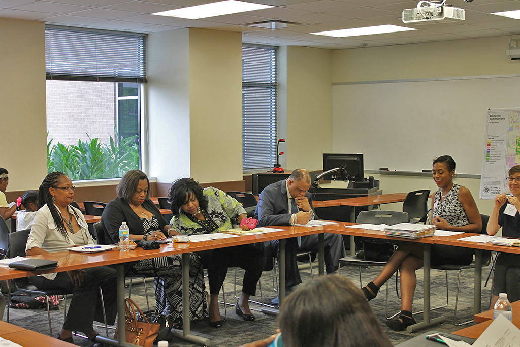
P&D worked jointly with the Complete Communities Advisory Committee and Neighborhoods Support Teams on the planning process
What's Next
The Complete Communities Action Plans will be presented to the public for final comment between January and March 2018. After an open house in each of the five Complete Communities, each Plan will be presented to City Council for endorsement. Published plans will be available by Spring/Summer 2018. In many cases, City departments have already begun implementation. To learn about projects that are underway, visit the Complete Communities web page and sign up for the monthly eNewsletter.
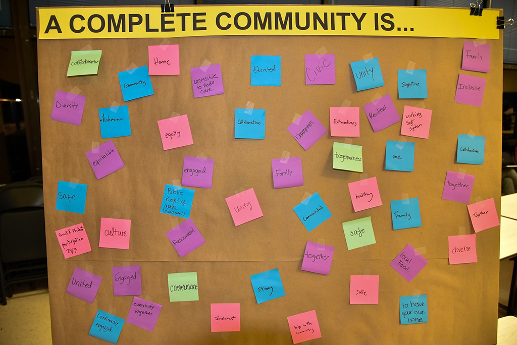

Neighborhood residents were asked what words best describe what "A Complete Community is...?"
Safer Streets Program
In June 2017, P&D, in partnership with Houston Public Works and Bloomberg Associates, launched
the Safer Streets Program. The program includes developing an Action Plan for Safer Streets focused on improving safety of pedestrians and cyclists. Through a combination of data analysis and community input, several locations in the five Complete Community neighborhoods with safety concerns were identified. P&D and Bloomberg Associates hosted a workshop bringing engineers, planners, other professionals and community representatives together to develop street design concepts on the pilot locations. Five locations were selected as pilot projects and
three are scheduled for implementation in early 2018.
Limited/General Purpose Annexations
The Department helps manage boundary changes within the city limits and in the City’s extraterritorial jurisdiction (ETJ). These boundary changes are made necessary because of a growing and changing region.
In 2017, Houston’s city limits grew through six limited purpose annexations that accompanied strategic partnership agreements with area utility districts. The City also disannexed one area. The annexations and disannexation are as follows:
2017 Annexations
Entity Name |
Area (Acres) |
Limited Partnership Agreements |
|
Cypress Creek |
42.32 |
HC ID 17 |
107.84 |
HC MUD 191 |
4.88 |
HC MUD 278 |
61.49 |
HFBC MUD 5 |
16.39 |
Kingsbridge MUD |
12.38 |
Total Area Annexed |
245.30 |
Disannexations |
|
IH-45 Rankin Road Area |
3.00 |
Total City Area Added |
242.30 |
Plan Houston
![]() Plan Houston continues to guide City departments in their efforts to
address community needs. Work on many of the Plan’s twelve core strategies is underway. Examples of new initiatives that support the
strategies include the Complete Communities program, preparation of a 10-year financial plan for the City, the Walkable Places project,
Plan Downtown, the Houston Bike Plan, and many others.
Plan Houston continues to guide City departments in their efforts to
address community needs. Work on many of the Plan’s twelve core strategies is underway. Examples of new initiatives that support the
strategies include the Complete Communities program, preparation of a 10-year financial plan for the City, the Walkable Places project,
Plan Downtown, the Houston Bike Plan, and many others.
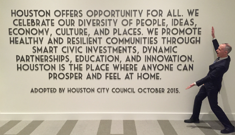
Plan Houston vision statement.
Prohibited Yard Parking Program
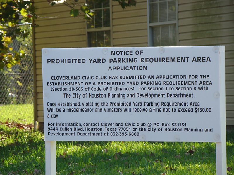 Another tool available to communities is the Prohibited Yard Parking Program ( PYP ), which allows property owners to establish an area where the parking of vehicles on front or side yards of single family residential properties is prohibited. In 2017, the P&D processed six PYP applications through City Council. There were 195 designated PYP areas in Houston as of December 31, 2017.
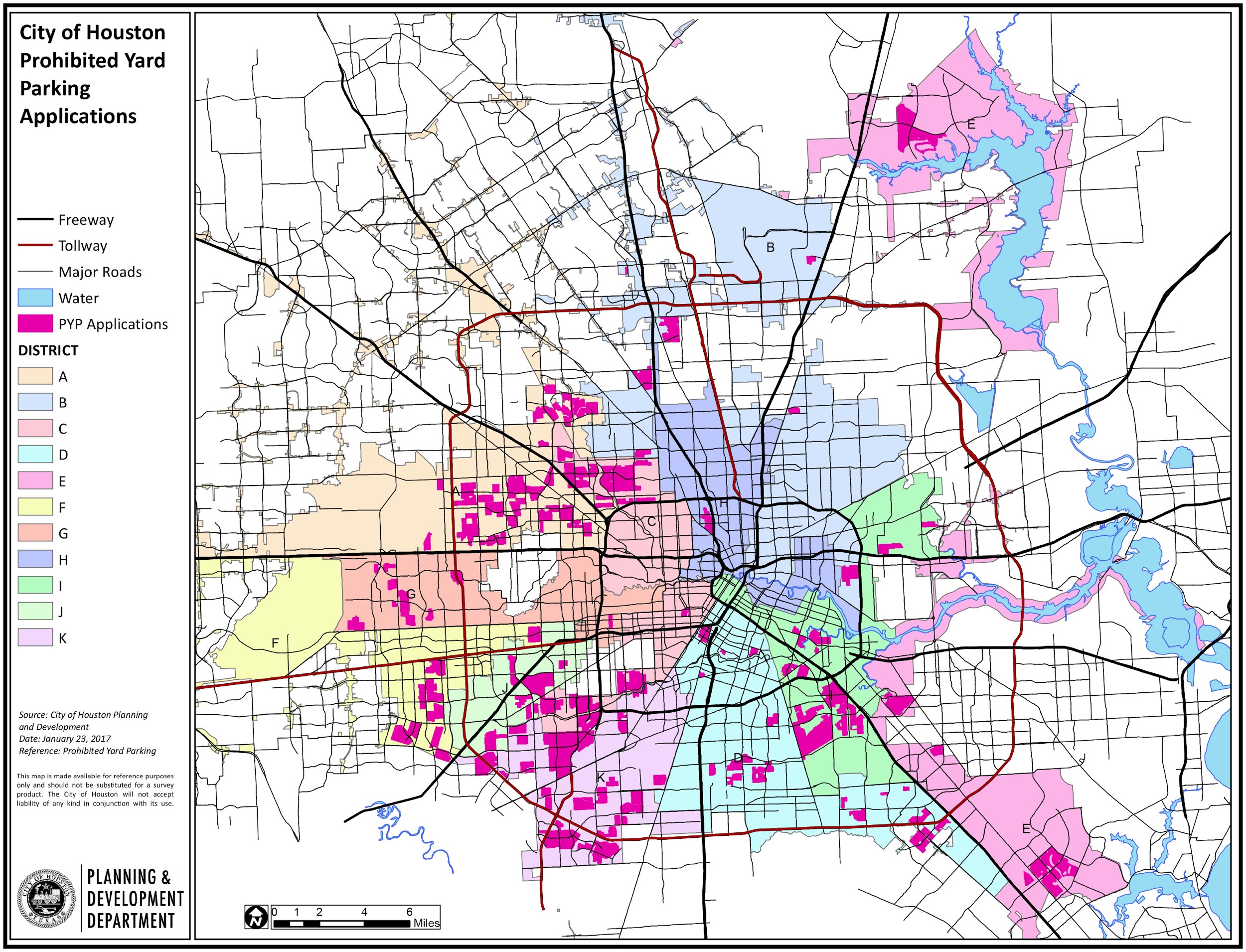
Prohibited Yard Parking Applications
Special Minimum Lot Size/Building Line Program
The Special Minimum Lot Size Program establishes a minimum square footage of lots within a specific area. This opt-in protection helps neighbors maintain a more “traditional” single family style of neighborhood. The Special Minimum Building Line works similarly by establishing a minimum building setback to which any future development must adhere. In 2017, the Department processed 60 applications for these programs - 53 Special Minimum Lot Size Blocks, 2 Special Minimum Lot Size Areas, and 5 Special Minimum Building Line Blocks. As of December 31, 2017, the total number of protected properties for the Minimum Lot Size and Minimum Building Line Programs is 20,211 and 3,283 respectively.
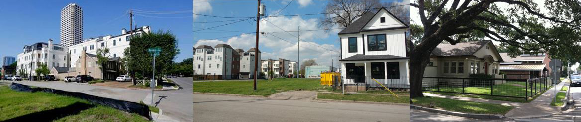
Redevelopment can change the character of a neighborhood.
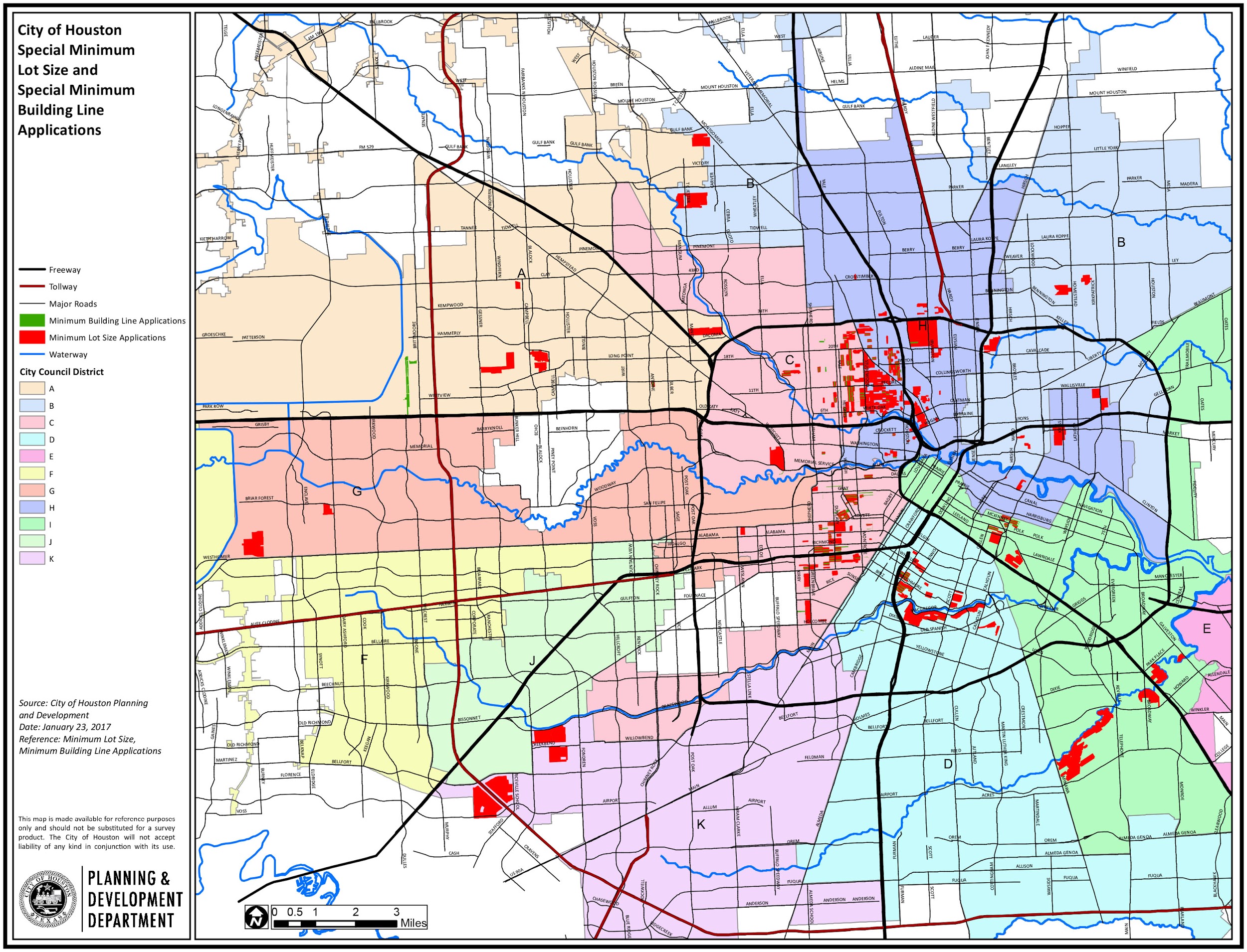
Special Minimum Lot Size/Building Line Areas
The city’s growth and redevelopment is supported by the approval of subdivision plats and replats in accordance with the City’s land development ordinance, Chapter 42. P&D staff reviews development submittals inside the 669 square miles of the city and the 1,171 square mile extra-territorial jurisdiction (ETJ) for compliance with Chapter 42 as well as other ordinances such as off-street parking (Chapter 26) and trees and shrubs (Chapter 33), as applicable. Regulation of development with unique considerations such as hotel/motels, hazardous material enterprises, Certificates of Compliance, and cellular towers are a part of the Department’s responsibilities. The Department makes recommendations on many of these applications to the Planning Commission .
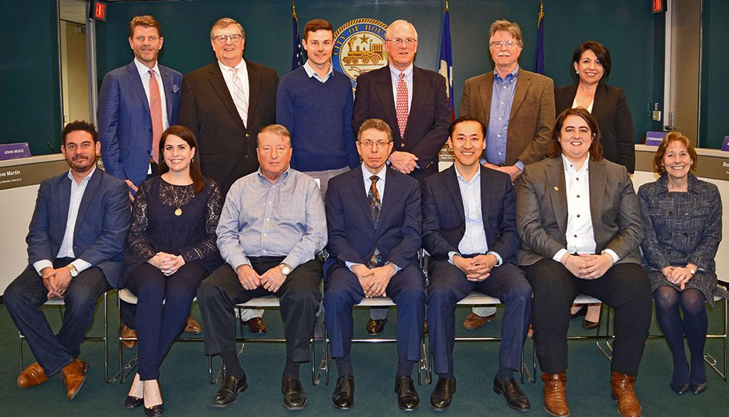
2017 Planning Commission
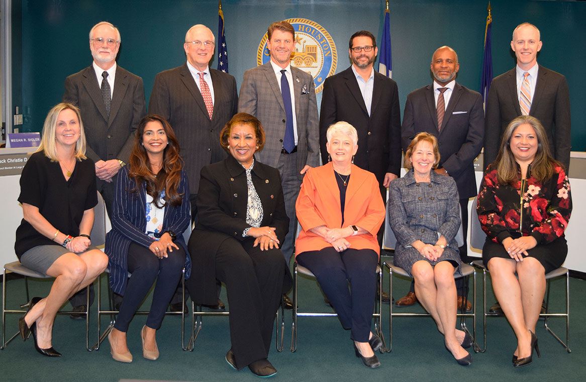
2017 Planning Commission, top row (left to right): Charles O. Dean, Mark Kilkenny, Bill Baldwin, Ian Rosenberg, Raymond Anderson, and P&D Director Patrick Walsh. Bottom row (left to right): Megan R. Sigler, Meera D. Victor, Algenita Davis, Marty Stein-Chair, Susan Alleman, and Lydia Mares.
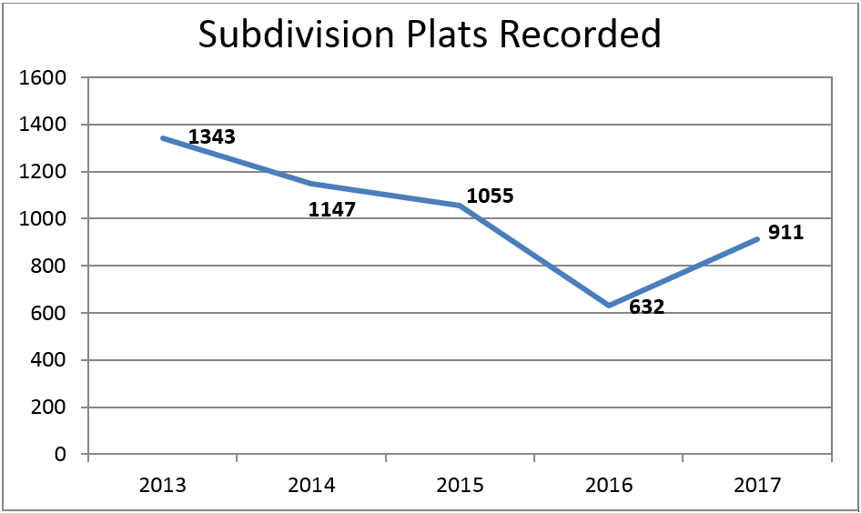
Plats and Plans
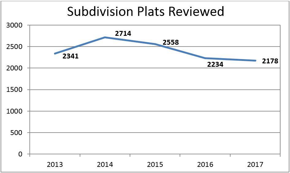
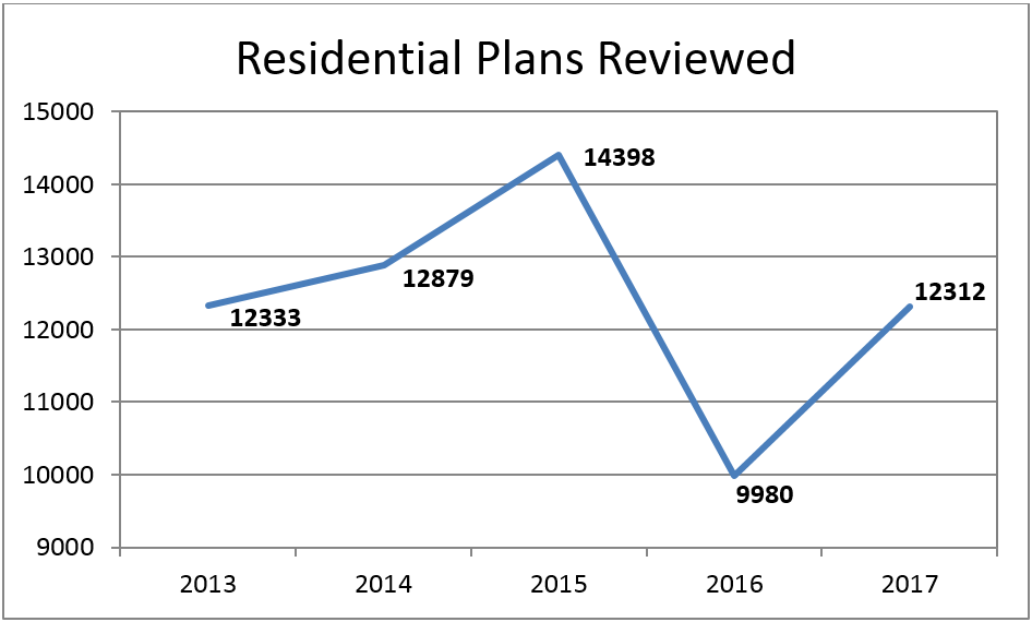
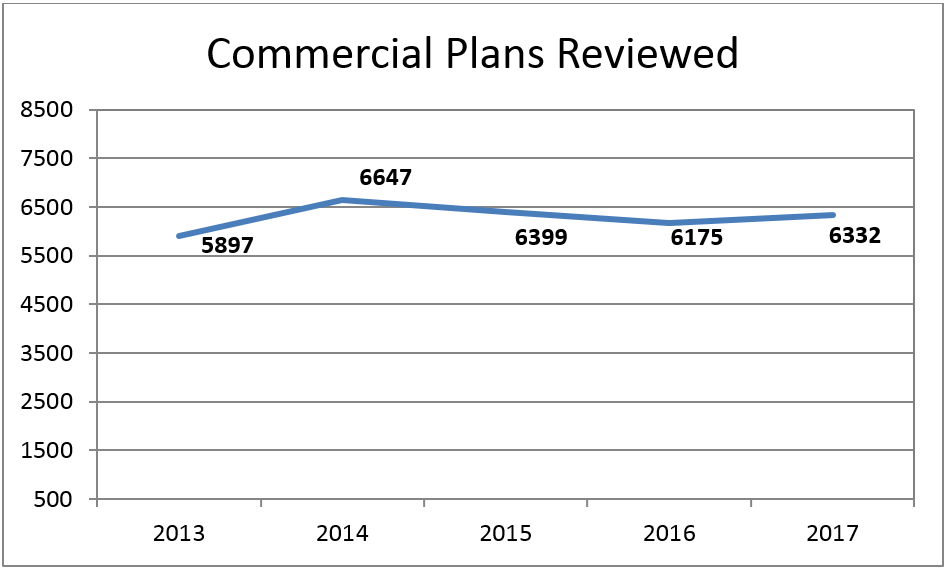
In 2017, the Department saw a slight decrease in the number of subdivision plat applications submitted; however, there was an increase in the number of subdivision plats recorded. The total number of commercial and residential plans reviewed increased slightly since 2016.
Plats & Plans
The map below shows the location of proposed development during 2016 and 2017. As you can see, a significant amount of platting of large parcels occurred along the Grand Parkway in Southwest, West and North Houston. Significant platting of smaller properties occurred throughout the city as well.
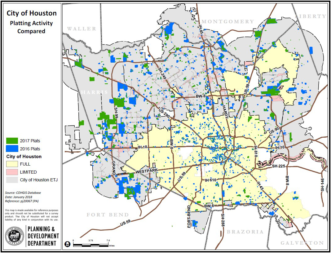
All Platting Activity for 2016 & 2017
Customer Service
In 2017, the Department consistently met its goal of reviewing 90% of commercial plans in five business days and 90% of residential plans in three business days with the exception of the days following Hurricane Harvey. P&D aims to provide a high level of customer service and uses metrics to ensure service goals are achieved. The following graphic demonstrates the high service levels achieved in 2016 and in 2017.

Plan Reviews Occurring Within Goal
Off-Street Parking
In 2017, City Council approved the amendments to Chapter 26, the off-street parking ordinance. These amendments included the following: adding the Planning Director’s authority to enforce penalties for violations; creating an annual submittal calendar for parking variances and special parking areas; extending the distance to off-site parking facilities from 250 to 500 feet; and creation of the administrative modification of parking requirements which allows the Director to approve a reduction of up to five parking spaces for an existing business.
Walkable Places
In 2017, the Houston Planning Commission launched the Walkable Places Project . The project will develop approaches to promote walkable development that are more context sensitive. Today’s development code encourages a suburban style of development, which is not appropriate for walkable urban areas. Some of the characteristics of a walkable place include reduced building setbacks, pedestrian friendly building elements, wider sidewalks and unique parking arrangements.
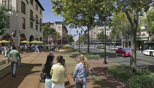
Walkable PLaces
“Houston is growing in record numbers. More than ever, our citizens want walkable places that connect to parks and activity centers. Our city needs to grow and develop responsibly and efficiently, under the guidance of the Code of Ordinances.” - Mayor Sylvester Turner
The Walkable Places Committee, chaired by members of the Planning Commission and comprised of a broad spectrum of community stakeholders, will review and recommend changes to Chapters 26, 33, and 42 of the City’s Code of Ordinances to encourage more pedestrian-friendly, walkable development. The committee has gathered examples of other major metropolitan areas and found what methods fit Houston’s unique development environment. After months of discussing different options, the committee is focusing on an application-based process that will allow the formation of Walkable Place Districts. Under this process, applicants will create a unique set of rules for the proposed district that are context sensitive and supported by the community. The program and proposed ordinance amendments are still under development and will be presented to the Planning Commission and City Council in the latter half of 2018.
Walkable Places Committee
2017 Walkable Places Committee, top row (left to right): Bill Baldwin-Vice Chair, Truman Edminster, James Llamas, Mark Kilkenny-Chair, Michael Huffmaster, and Veronica Chapa Gorczynski. Bottom row (left to right): Josh Sanders, Abbey Roberson, Greg LeGrande, Ron Lindsey, George Levan, Isabel Longoria, and Susan Alleman.
Tower Commission
The City of Houston requires a tower permit for towers 60 feet tall or higher. The Tower Commission, a seven-member board, considers requests for waivers, appeals on disapproved towers, and appeals from affected property owners, associations or groups on tower permit applications. Staff processed a total of 19 tower applications in 2017. Below is a breakdown of the applications.
2017 Approval Rates
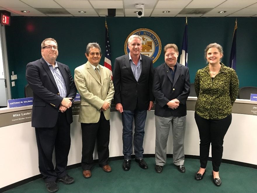
2017 Tower Commission (left to right): P&D Assistant Director Michael Kramer, Antonio Salinas, Rob Todd- Chair, John R. Melcher, and Christy B. Smidt.
Historic Preservation

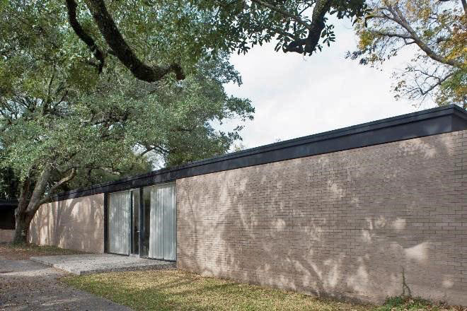
LEFT: Landmark-1932 Albans Road RIGHT: Protected Landmark-9 Shadow Lawn Street
Houston’s history is kept alive through its historical structures and neighborhoods. The Planning & Development Department and the Houston Archaeological and Historical Commission (HAHC) are stewards to Houston’s historical heritage through the City’s Historic Preservation Office, which governs the City’s 22 historic districts, 290 landmarks, and 150 protected landmarks. Any new construction, demolition, or alterations to structures in historic districts and historic landmarks requires a Certificate of Appropriateness (COA). Statistics on the approval rates of COAs over the last five years are shown below.
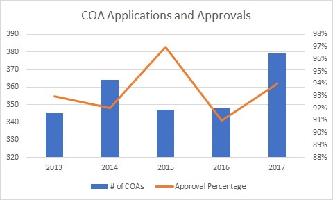
COA Applications & Approvals
2017 Approval Rates
2017 Staff Review
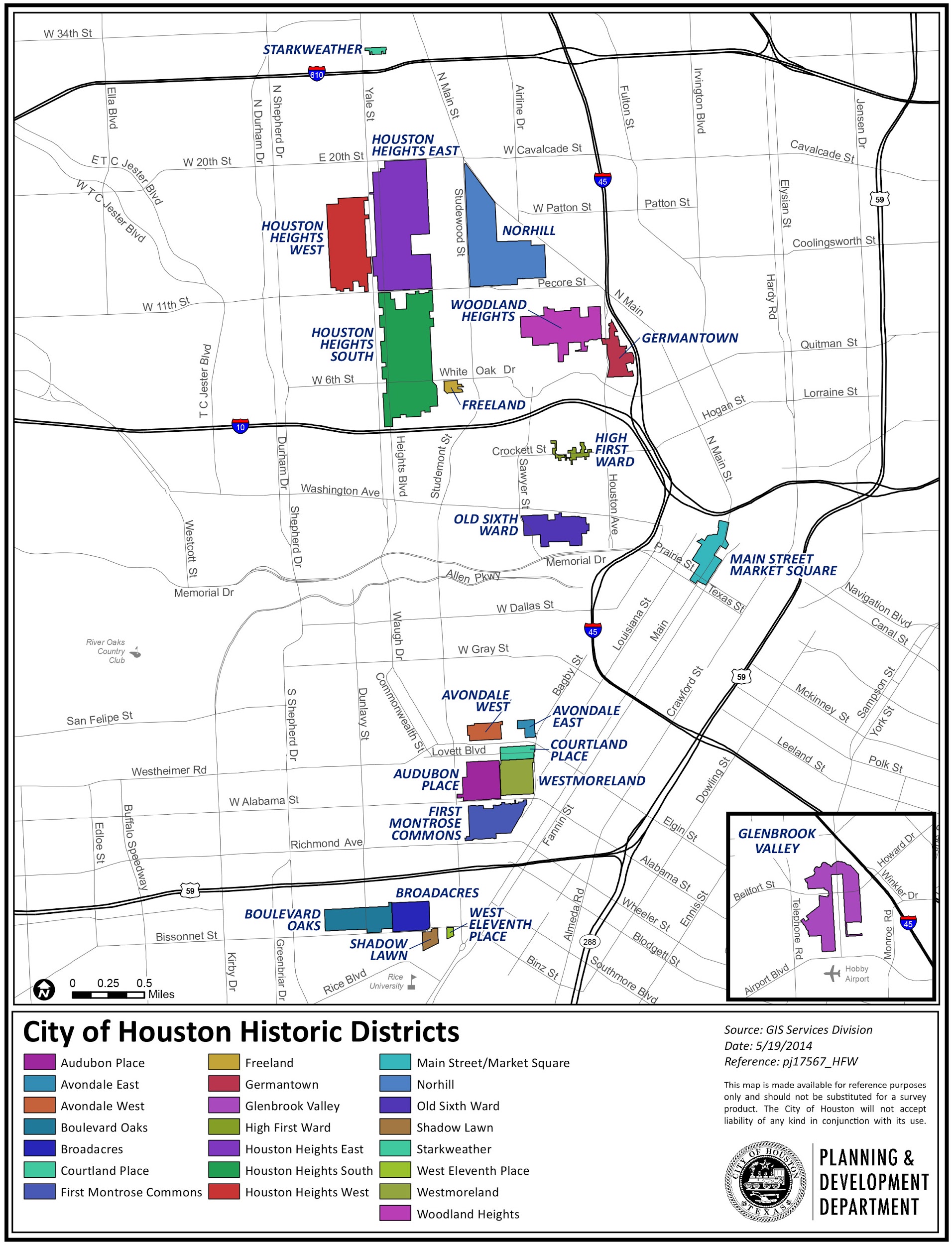
Historic Districts
Heights Historic Districts Design Guidelines
The City of Houston currently has 22 historic districts, and its Historic Preservation Ordinance is written broadly to apply to all of them. The HAHC directed Historic Preservation staff to develop design guidelines for the three Houston Heights historic districts. The design guidelines will be district-specific and provide predictability for applicants wanting to alter or construct structures within these districts. Since 2010, the City’s Historic Preservation ordinance has required the Planning & Development Department to develop design guidelines for new historic districts. This project is the first to create design guidelines for existing historic districts.
In 2017, design guidelines consultants Winter and Company completed a survey of property owners in the Phase I historic districts (Houston Heights East, West, and South; Norhill; Woodland Heights; and Freeland) and presented their results and recommendations. That data was used to create a draft of the Houston Heights Historic Districts Design Guidelines that was published in June and revised in August. Following public comment periods after the release of both versions, the Department brought recommendations for additional revisions to HAHC in October. The Commission made additional changes and approved the Design Guidelines in December 2017. Throughout the year, the P&D continued to meet and work with neighborhood representatives in the other districts to keep the project moving there, as well as with the Old Sixth Ward Protected Historic District, which will be updating its existing design guidelines. The first set of design guidelines, for the Houston Heights Historic Districts, will go to City Council in 2018. Below are brief highlights of this effort:
HAHC Historic Highlights

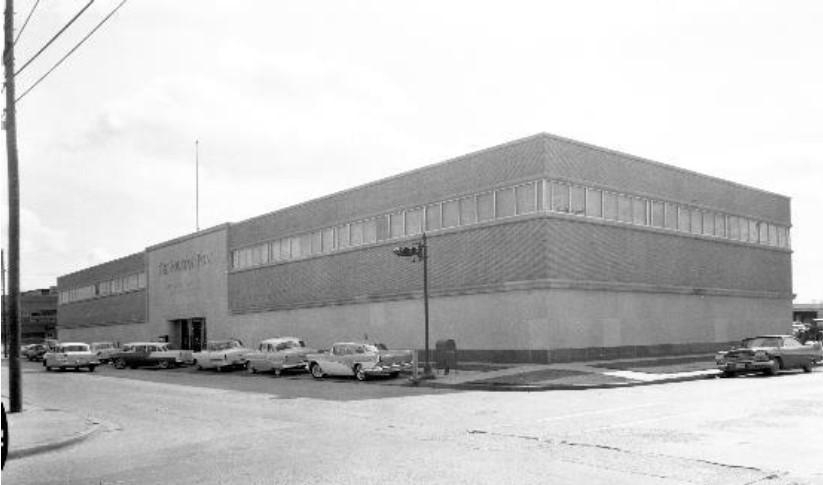
LEFT: Downtown Post Office RIGHT: Houston Post Building
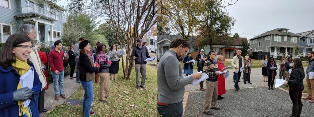
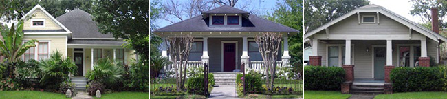
Houston Heights Historic Districts Tour
2017 Houston Archaeological and Historical Commission
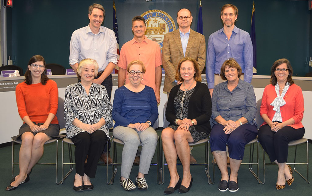
2017 Houston Archaeological and Historical Commission, top row (left to right): John Cosgrove, Stephen McNeil, Charles Stava, and Ben Koush. Bottom row (left to right): Emily Ardoin-Vice Chair, Ann Collum, Edie Archer, Minnette Boesel-Chair, Sue Lovell, and P&D Deputy Director Margaret Wallace Brown.
Historic Preservation Appeals Board
The Historic Preservation Appeals Board is a 5-member board that considers appeals of decisions of the Houston Archaeological and Historical Commission (HAHC). The board meets on an as-needed basis. The board upheld the HAHC decision on two appeals in 2017.

2017 Historic Preservation Appeals Board (left to right): Fernando L. Brave, Betty Trapp Chapman, Margaret, J. D. Bartell-Chair, Dr. Carol A Lewis, and Tanya Debose.
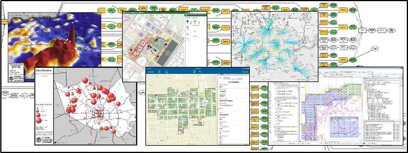
Collage of maps produced from GIS data
The Department maintains the City’s core Geographic Information System (GIS) and is the repository for data pertaining to streets, public facilities and services, special districts, population demographics, and housing. It also collects and uses information from private entities and local, state and federal public agencies to provide street maps, aerial imagery and tabulated data for all aspects of the City. The ability to analyze and show data by specific geographic areas provides both citizens and the City officials a powerful tool to learn about locations of interest. This data is displayed on My City , the City’s primary GIS site. There are three teams of GIS professionals in the Planning & Development Department:
Addressing
The GIS Addressing Group maintains the City’s addressing database, street network, and maintains the various GIS municipal boundaries. This group also verifies and assigns all new addresses for the City. Notable Addressing activities for 2017 included:
Mapping and Analysis
The GIS Mapping and Analysis Group creates the maps and graphics for the City to assist in making informed decisions. Additionally, this team provides GIS training classes for all City departments. Notable Mapping and Analysis activities for 2017 included:
Houston Emergency Center
The GIS Houston Emergency Center (HEC) Group handles data related to Fire, Police, and the 911 call floor. Notable HEC activities for 2017 included:
Demographics
Houston, the 4th most populous city in America and one of the most ethnically diverse, is estimated to have had a population of 2,349,993 as of January 1, 2018.
P&D leads the City’s efforts to understand the demographics of our city and how Houston compares to its peers. The Department analyzes changes and trends in demographics; produces data and reports that inform and educate the community to make sound decisions for Houston’s future; and analyzes, compares and releases data/information related to population, permit activity, income, education, language, labor force, housing, and related characteristics on a bi-weekly basis. In 2017, the Department published a variety of charts and provided demographic and analytical support to various types of requests related to population, building permit and subdivision plat activities, language access, and other characteristics.
P&D periodically disseminates Census and related data for the city and region as depicted in the charts below.
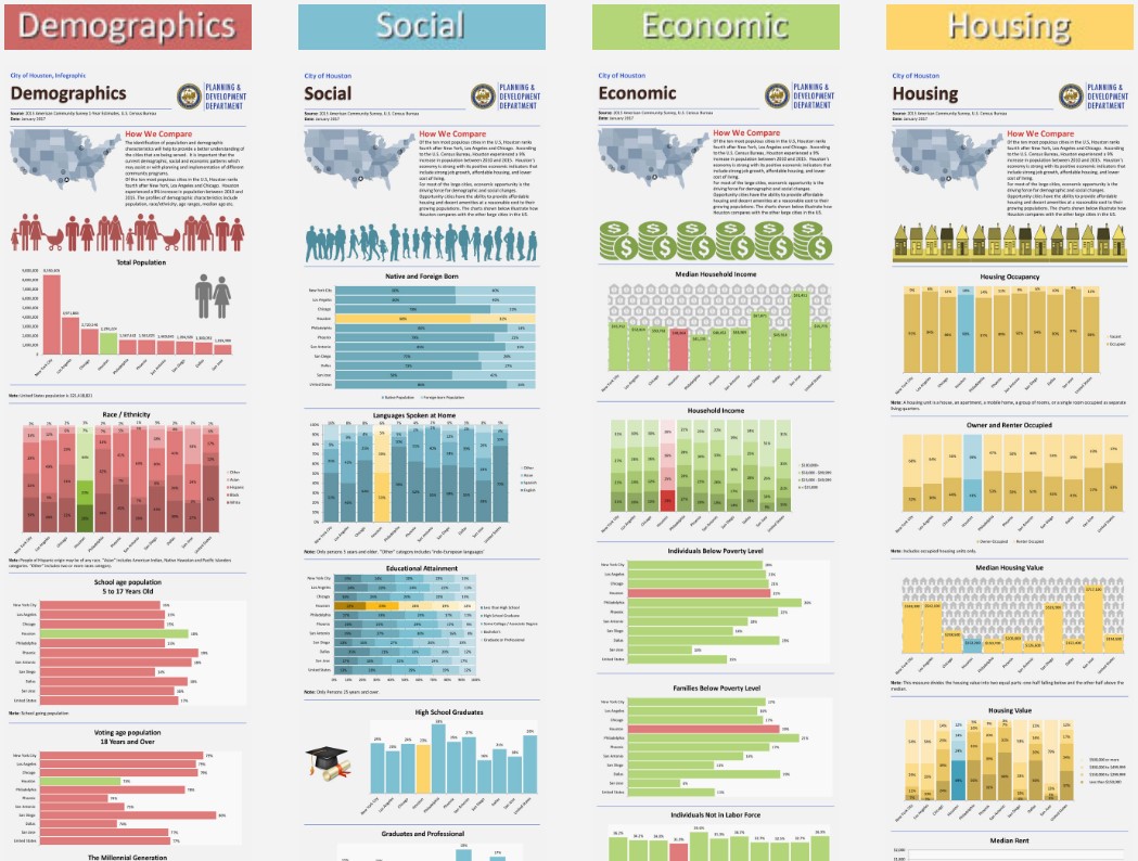
How We Compare Infographics
Super Neighborhood Profile Updates
![]() The P&D Demographics Group completed updates to all 88 Super Neighborhood Demographic Profiles for the 11 Council Districts using the most current data available from the American Community Survey data release. City Council district profiles were also revised and uploaded in the summer of 2017. These profiles contain interesting demographic data that is valuable to community organizations, stakeholders, and residents and helps inform city officials in the planning decision-making process. The Super Neighborhood demographic data also served as one of the major criteria in the selection of the Complete Communities.
The P&D Demographics Group completed updates to all 88 Super Neighborhood Demographic Profiles for the 11 Council Districts using the most current data available from the American Community Survey data release. City Council district profiles were also revised and uploaded in the summer of 2017. These profiles contain interesting demographic data that is valuable to community organizations, stakeholders, and residents and helps inform city officials in the planning decision-making process. The Super Neighborhood demographic data also served as one of the major criteria in the selection of the Complete Communities.
Complete Streets
P&D leads the City’s systems-level transportation planning. This function includes management of the City’s Complete Streets and Transportation Plan, Major Thoroughfare & Freeway Plan, Bicycle Master Plan, rail-related planning, local area studies, and external transportation funding efforts. The Department also supports other departments, including Houston Public Works, as projects are developed at the corridor level for capital improvements. In this way, the City sustains a seamless process for mobility improvements from planning through implementation.
Complete Streets and Transportation Plan Annual Report
In 2013, then-Mayor Annise Parker issued an Executive Order (E.O.) to develop a Houston Complete Streets and Transportation Plan (HCSTP) for the City of Houston. This Plan is meant to provide public streets that are safe, accessible, and convenient for use by motorists, public transit riders, pedestrians, bicyclists, and people of all ages and abilities. The Planning & Development Department and Houston Public Works are working in partnership to implement the Plan. The Plan requires the completion and update of a number of component plans, including the Major Thoroughfare & Freeway Plan, the Houston Bike Plan, and a Regional Transit Plan led by METRO. An Annual Report is required by the Complete Streets E.O. to provide the Mayor an update on implementation of the HCSTP. The Report reviews work completed in the past year, documents measurements of success, and lays out next steps for the upcoming year and beyond. The annual report for 2017 is under development. View the 2016 report in .pdf.
Major Thoroughfare & Freeway Plan
 P&D is responsible for maintaining the City’s Major Thoroughfare & Freeway Plan (MTFP). The MTFP identifies the required right-of-way and street hierarchy designation (local, collector, thoroughfare, or transit corridor) for each major street in Houston. The Department further incorporated the context-sensitive approach identified in the E.O. into the City’s annual process for amending MTFP. In 2017, P&D administered 54 amendments to the MTFP, 33 of which were within the city limits, with the remainder in the City’s extraterritorial jurisdiction (ETJ). These amendments were developed using the complete streets philosophy identified in the E.O.
Livable Center and Special District Studies
P&D works in partnership with Houston Public Works to represent the City of Houston in studies led by Houston-Galveston Area Council (H-GAC) and other non-City entities. H-GAC's Livable Centers Program works with local communities to identify specific recommendations, such as pedestrian and bicycle facilities, that foster the development of Livable Centers. Livable Centers, with concentrations of residential and employment land uses, support more trips by foot, bicycle, transit, or carpool. The Kashmere Gardens and the Hobby Area Livable Centers Studies were completed in 2017, and the Westchase District Livable Centers Study and the Spring Branch Livable Centers Study began in 2017 and will be completed in 2018.
Houston BCycle Expansion

New BCycle Stations
1.Emancipation Park Station 2.Gateway on Cullen Station 3.Moody Park Station
The Department sponsored an application in the 2015 Transportation Improvement Program Call for Projects and was awarded a $3.7 million federal grant to expand the City’s Houston BCycle program. The expansion project will add 71 bike stations and 568 bicycles to the bike share network and two transport vehicles for bike share operations. Prior to the grant award, the bike share network consisted of 33 bike stations and 225 bicycles. Program operator Houston Bike Share is the local match sponsor of the application and is overseeing implementation of the new stations.
Installation of the bike stations began in January of 2017. Eighteen new bike stations were installed in 2017 in the downtown area, Heights, Third Ward, Greater East End, Near Northside, Montrose, Museum District and Hermann Park, Houston Community College-Central and Rice University increasing the bike share network to 51 stations. Three additional bike stations were purchased to replace existing bike stations damaged during Hurricane Harvey. Future stations planned for 2018 include Texas Medical Center, University of Houston-Main, University of Houston-Downtown, Texas Southern University and other surrounding neighborhoods.
C40 Healthy, Livable Cities Grant Study
 In March 2017, the Planning & Development Department along with Houston Health Department was awarded a direct technical assistance grant from C40 on the evaluation of environmental and health benefits of the White Oak Bayou Trail for improving walkability and bikeability. C40, a network of the world’s megacities committed to addressing climate change, supports cities to collaborate effectively, share knowledge and drive meaningful, measurable and sustainable action on climate change. Through the 6-month process, the Houston team learned the best practices of the evaluation methodology and the experiences from other cities, and C40 and the ARUP consulting team provided the guidance on how to better utilize existing data, and identify gaps and additional data sources. The final report was completed in November 2017 which addresses the environmental, economic, and health benefits of the White Oak Bayou Greenway. The methodology and findings from this grant study will be included in a toolkit for assessing the intersectionality of public health and active transportation, and will be extended further for the evaluation of improving bike facilities and sidewalks in Houston.
Houston Bike Plan
![]() On March 22, 2017, the Houston City Council adopted the updated Bicycle Master Plan. This adoption is the first update of the Plan since 1993 and was led by P&D with assistance from Houston Public Works, Houston Parks & Recreation, and a host of other partners. The Plan identifies projects that will create a city-wide bicycle network to serve a broad spectrum of people who bike at all skill levels, provide more transportation choices, and build on efforts such as the Bayou Greenways Initiative to create a well-connected city-wide bicycle system of both on and off-street facilities.
On March 22, 2017, the Houston City Council adopted the updated Bicycle Master Plan. This adoption is the first update of the Plan since 1993 and was led by P&D with assistance from Houston Public Works, Houston Parks & Recreation, and a host of other partners. The Plan identifies projects that will create a city-wide bicycle network to serve a broad spectrum of people who bike at all skill levels, provide more transportation choices, and build on efforts such as the Bayou Greenways Initiative to create a well-connected city-wide bicycle system of both on and off-street facilities.
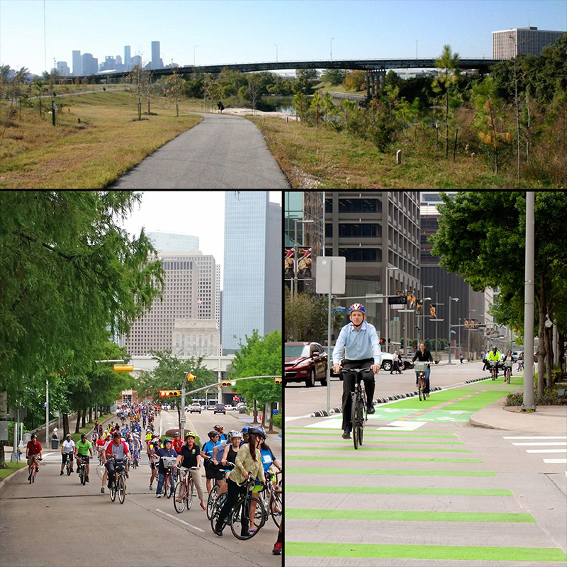
VISION: By 2027, the City of Houston will be a Safer, More Accessible, Gold Level Bike-Friendly City and will more than triple the mileage of the current 270 mile high-comfort bikeway network.
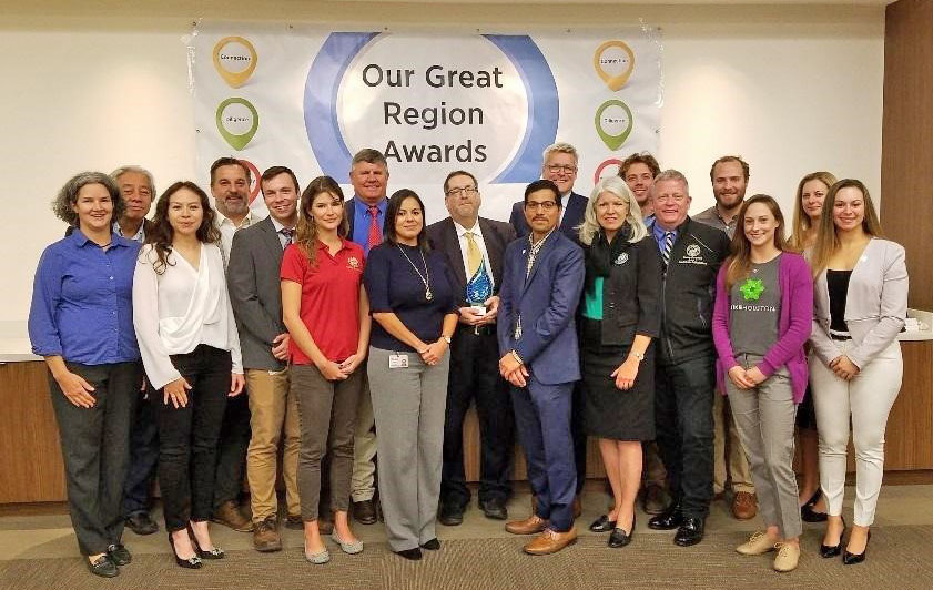
In addition to the Plan’s adoption, Chapter 33 of the City’s Code of Ordinances was updated to mandate a biennial amendment and review process of the Plan and a standing Bicycle Advisory Committee. The Bicycle Master Plan is a component plan of the Houston Complete Streets and Transportation Plan and fulfills the Executive Order requirement for a bikeway plan. P&D staff is currently working on establishing the Bicycle Advisory Committee and working with Houston Public Works to create a process for implementing bike plan recommendations. Most recently, the Houston Bike Plan was awarded the 2017 Our Great Region Connection Award by the Houston-Galveston Area Council.
City of Houston Bike Plan Team and Partners
Lower Westheimer Corridor Study
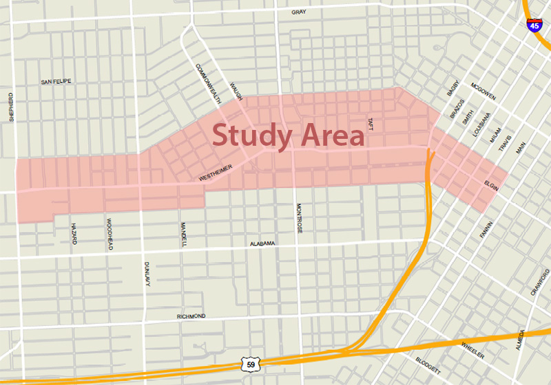 The Planning & Development Department and Houston Public Works jointly led a pilot enhanced pre-engineering study for the Lower Westheimer Corridor . This study is Houston’s first enhanced pre-engineering process, which is for unique streets that merit an advanced level of design sensitivity due to historic, cultural, or community significance. As part of this process, the City collaborates elected officials, property owners, residents, business owners, and community stakeholders to develop a preferred design that enhances the character of the corridor, while improving mobility and safety. The Stakeholder Advisory Committee for the Lower Westheimer study is an example of enhanced community engagement involving community leaders. The study was completed in early 2018.


Lower Westheimer Corridor Study Community and Stakeholder Meetings
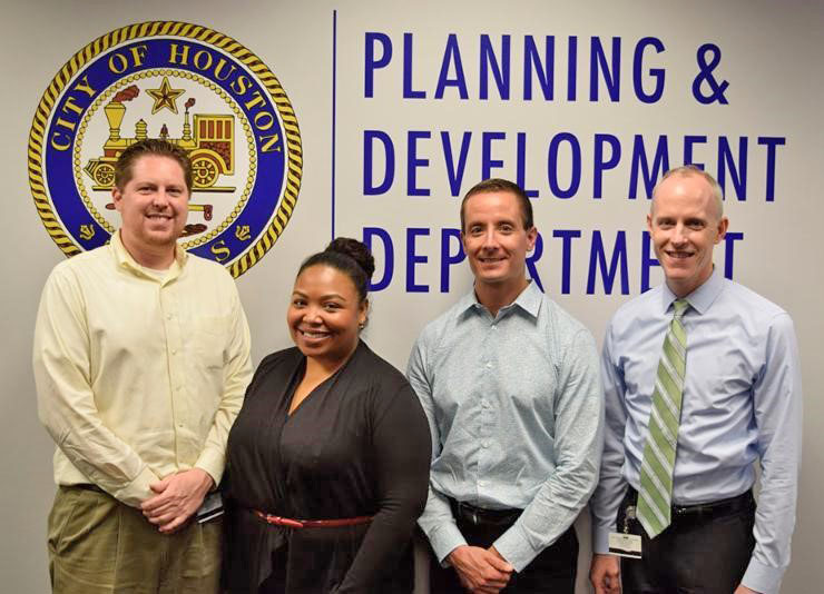
The Planning & Development Department is comprised of approximately 85 dedicated public servants who strive to make Houston a better place to live, work, and play.
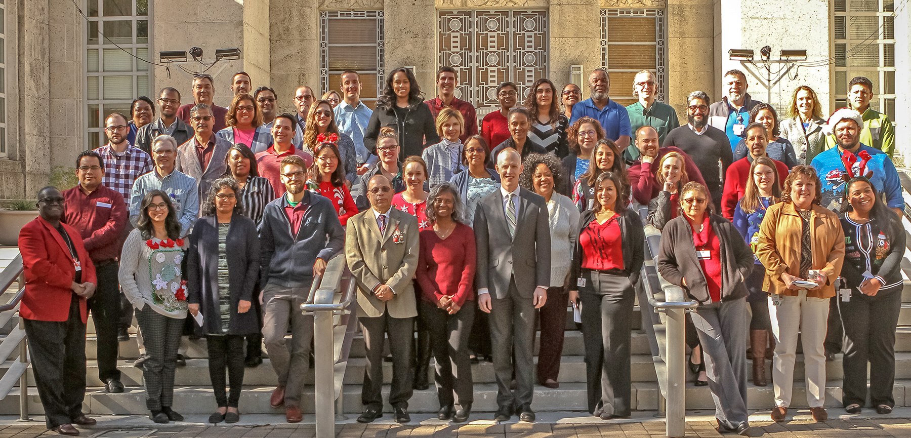
Planning & Development Staff
Combined Municipal Campaign
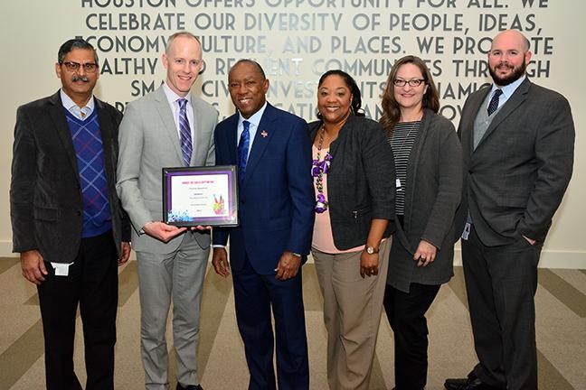
Each year City employees raise money for various charities through the Combined Municipal Campaign (CMC). In 2017, P&D raised a total of $10,269.40 for the CMC by hosting a variety of fundraising events, from selling breakfast tacos to a department costume contest. A portion of the proceeds raised benefited the City of Houston Employee Assistance Fund for City employees affected by Hurricane Harvey. On behalf of these efforts, Mayor Turner presented P&D with the Highest Per Capita Contribution Award, awarded to departments with under 200 employees, and recognized six P&D employees for generously donating 1% of their salary to CMC organizations.
2017 CMC Campaign Awards Ceremony
2017 P&D Excellence Service Awards
P&D recognizes employees for outstanding job performance and years of service to the City of Houston at an annual department service awards ceremony. The P&D Excellence Service Awards honors individuals identified by their supervisors, peers, or colleagues in other departments, as having consistently excelled in their positions and demonstrated integrity and a strong commitment to the mission and values of the department in three areas of performance: Excellence in Customer Service Award, Exemplary Achievement or Performance and Outstanding Collaboration.
2017 Award Recipients (left to right)
 Kevin Shuff - Exemplary Achievement or Performance Award
Misty Staunton - Outstanding Collaboration Award
Eric Pietsch - Excellence in Customer Service Award
Pat Walsh - PD Director
Visit us at HoustonPlanning.com