
 > Police >
POLICE Department
Crime Statistics for North Patrol Division
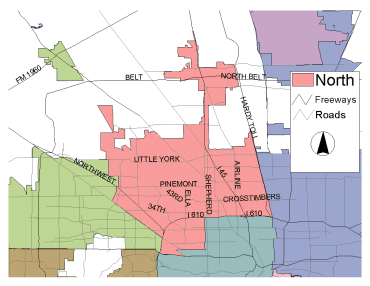
Estimated Population: 258,808
Approximate Square Miles: 54.9
3B10
Approximate street boundaries:
North: W.Tidwell
East: White Oak Bayou
South: 610
West: Hempstead to Southerland
Landmarks/Neighborhoods: Northwest Mall, Brookhollow, White Oak
Acres, Oak Forest, Langwood
Click here for a detailed text description
of the boundaries of this beat.
Click here for a detailed map of this beat.
3B20
*** NOTE: On January 1, 2007, 3B20's Beat Became 2A60's Beat and is now patrolled by Central. ***
Approximate street boundaries:
North: 610 North Loop West
East: N.Durham
South: 1-10
West: 610 West Loop North
Landmarks/Neighborhoods: Westport, Holly Park, Lazy Brook, Citadel,
Shady Acres, Timbergrove
Click here for a detailed text description
of the boundaries of this beat.
Click here for a detailed map of this beat.
3B30
Approximate street boundaries:
North: Pinemont
East: N.Shepherd
South: 610
West: White Oak Bayou
Landmarks/Neighborhoods: White Oak Acres, Brook Hollow, Oak Forest,
Garden Oaks, Shepherd Park Plaza
Click here for a detailed text description
of the boundaries of this beat.
Click here for a detailed map of this beat.
3B40
Approximate street boundaries:
North: Tidwell
East: 1-45
South: 610
West: N.Shepherd
Landmarks/Neighborhoods: Independence Heights, Melrose, Graceland
Terrace
Click here for a detailed text description
of the boundaries of this beat.
Click here for a detailed map of this beat.
3B50
Approximate street boundaries:
North: Tidwell
East: Hardy Toll Road
South: 610
West: I-45
Landmarks/Neighborhoods: Northline Mall, Stratton Place, Oakwood,
Colonial Gardens, Lindale, Junction City
Click here for a detailed text description
of the boundaries of this beat.
Click here for a detailed map of this beat.
6B10
Approximate street boundaries:
North: W.Canino
East: Hardy Toll Road
South: Tidwell
West: I-45
Landmarks/Neighborhoods: York Plaza, Pembrook Place, Hawthorne
Place
Click here for a detailed text description
of the boundaries of this beat.
Click here for a detailed map of this beat.
6B20
Approximate street boundaries:
North: W.Little York
East: I-45
South: Pinemont
West: White Oak Bayou
Landmarks/Neighborhoods: Highland Heights, Oakdale, Melrose Gardens
Click here for a detailed text description
of the boundaries of this beat.
Click here for a detailed map of this beat.
6B30
Approximate street boundaries:
North: Gulf Bank
East: White Oak Bayou near T.C. Jester
South: W. Tidwell
West: Langfield to Hollister
Landmarks/Neighborhoods: Woodland Trails, Oaks of Inwood, Bayou
Bend, Cole Creek Manor, Inwood Forest
Click here for a detailed text description
of the boundaries of this beat.
Click here for a detailed map of this beat.
6B40
Approximate street boundaries:
North: W. Gulf Bank to W. Mount Houston
East: City Limits east of I-45
South: W. Little York
West: East of T.C. Jester
Landmarks/Neighborhoods: Highland Gardens, Highland Heights, North
Plaza
Click here for a detailed text description
of the boundaries of this beat.
Click here for a detailed map of this beat.
6B50
Approximate street boundaries:
North: Beltway 8
East: Hardy Toll Road
South: West Road
West: I-45
Landmarks/Neighborhoods: Aldine, Imperial Valley
Click here for a detailed text description
of the boundaries of this beat.
Click here for a detailed map of this beat.
6B60 (established in August 2005)
Approximate street boundaries:
North: Spears / Rankin
East: E. Hardy
South: Beltway 8
West: Northborough
Landmarks/Neighborhoods: Greenspoint
Click here for a detailed text description
of the boundaries of this beat.
Click here for a detailed map of this beat.