
 > Police >
POLICE Department
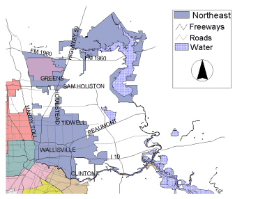
Crime Statistics for Northeast Patrol Division
Estimated Population: 203,450
Approximate Square Miles: 134.1
7C10
Approximate street boundaries:
North: Liberty
East: Zindler
South: Buffalo Bayou
West: Elysian
Landmarks/Neighborhoods: Fifth Ward, North Park, Pinecrest
Click here for a detailed text description
of the boundaries of this beat.
Click here for a detailed map of this beat.
7C20
Approximate street boundaries:
North: HB&T RR Tracks
East: HB&T RR Tracks
South: Liberty
West: MPRR RR Tracks
Landmarks/Neighborhoods: Huntington Place, Willshire Place, Kashmere
Gardens, Liberty Gardens
Click here for a detailed text description
of the boundaries of this beat.
Click here for a detailed map of this beat.
7C30
Approximate street boundaries:
North: Parker
East: Hirsch
South: SPRR RR Tracks
West: Hardy Toll Road
Landmarks/Neighborhoods: Camden Woods, Archers Acres, Croyden
Gardens
Click here for a detailed text description
of the boundaries of this beat.
Click here for a detailed map of this beat.
7C40
Approximate street boundaries:
North: Aldine Mail Road to Little York
East: SPRR RR Tracks to Eastex Fwy
South:Parker
West: Hardy Toll Road to Aldine Westfield
Landmarks/Neighborhoods: Keith-Weiss Park, Farrington Place
Click here for a detailed text description
of the boundaries of this beat.
Click here for a detailed map of this beat.
7C50
Approximate street boundaries:
North: FM 1960
East: Eastex Fwy
South: Beltway
West: Aldine Westfield
Landmarks/Neighborhoods: Intercontinental Airport, Northwood,
Lakeview Park, Glen Lee
Click here for a detailed text description
of the boundaries of this beat.
Click here for a detailed map of this beat.
Crime stats for this beat: click
here.
8C10
Approximate street boundaries:
North: Halls Bayou
East: Wescott Road
South: MPRR RR Tracks
West: SPRR RR Tracks
Landmarks/Neighborhoods: Tidwell Park, Shady Oak, Buckingham Place
Click here for a detailed text description
of the boundaries of this beat.
Click here for a detailed map of this beat.
8C20
Approximate street boundaries:
North: Wescott Road
East: HB&T RR Tracks
South: HB&T RR Tracks
West: MPRR RR Tracks
Landmarks/Neighborhoods: Houston Gardens, Rosewood, Homestead
Click here for a detailed text description
of the boundaries of this beat.
Click here for a detailed map of this beat.
8C30
Approximate street boundaries:
North: Halls Bayou
East: Mesa Road
South: Liberty
West: HB&T RR Tracks
Landmarks/Neighborhoods: Parkhurst, East Houston, Clairmont Place
Click here for a detailed text description
of the boundaries of this beat.
Click here for a detailed map of this beat.
8C40
Approximate street boundaries:
North: Tidwell
East: Greens Bayou
South: Old Beaumont Hwy
West: Mesa
Landmarks/Neighborhoods: Lake Houston, Greenriver, Knoll, Lake
Forest
Click here for a detailed text description
of the boundaries of this beat.
Click here for a detailed map of this beat.
8C50
Approximate street boundaries:
North: City Limits
East: City Limits
South: Tidwell
West: MPRR RR Tracks
Landmarks/Neighborhoods: Park North, Forest Green, Kentshire Place,
Glenwood Forest, Dorchester
Click here for a detailed text description
of the boundaries of this beat.
Click here for a detailed map of this beat.
8C60
Approximate street boundaries:
North: Mount Houston
East: MPRR RR Tracks
South: Halls Bayou
West: Hirsch
Landmarks/Neighborhoods: Edgeworth, Northwood Manor, Scenic Woods
Click here for a detailed text description
of the boundaries of this beat.
Click here for a detailed map of this beat.
9C10
Approximate street boundaries:
North: I-10 East Fwy
East: Fidelity
South: Houston Ship Channel
West: East of McCarty
Landmarks/Neighborhoods: Port of Houston, Clinton Park, Pleasantville,
Fidelity Manor
Click here for a detailed text description
of the boundaries of this beat.
Click here for a detailed map of this beat.
9C20
Approximate street boundaries:
North: Liberty
East: 610 North Loop East to McCarty
South: Houston Ship Channel
West: Lockwood
Landmarks/Neighborhoods: Denver Harbor, Houston Harbor
Click here for a detailed text description
of the boundaries of this beat.
Click here for a detailed map of this beat.
9C30
Approximate street boundaries:
North: Liberty
East: Greens Bayou to Wallisville to Hunting Bayou
South: I-10 East Fwy
West: 610 North Loop East
Landmarks/Neighborhoods: City Park East, Wynnewood Acres, Wallisville
Gardens
Click here for a detailed text description
of the boundaries of this beat.
Click here for a detailed map of this beat.
9C40
Approximate street boundaries:
North: Wallisville
East: Greens Bayou
South: Industrial Road
West: Hunting Bayou
Landmarks/Neighborhoods: Greens Bayou Estates, Shady Brook, Northshore
Click here for a detailed text description
of the boundaries of this beat.
Click here for a detailed map of this beat.
Kingwood
24C10
Click here for a detailed map of this beat.
24C20
Click here for a detailed map of this beat.
24C30
Click here for a detailed map of this beat.
24C40
Click here for a detailed map of this beat.
24C50
Click here for a detailed map of this beat.