Building Houston

2018 Annual Report
2018 Annual Report

As a 33-year employee of the Planning and Development Department, I am honored to serve as Interim Director. I look forward to continuing the work of the department, and collaborating with Mayor Sylvester Turner, City Council, and partners on projects that lead to further enhancement of our communities.
P&D aims to help neighborhoods become more vibrant, resilient, and engaged. Several project milestones were reached in 2018 and are detailed in this report. These successes include: the completion of five Action Plans for Mayor Turner’s signature program, Complete Communities, the adoption of the Houston Heights Historic Districts Design Guidelines, creation of a Bicycle Advisory Committee and a $10 million funding partnership with Harris County Commissioner Rodney Ellis for bikeway implementation!
This report also provides an update on other new, exciting projects led by our department like Walkable Places, which will hopefully lead to changes in the code to encourage walkable development, North Houston Highway Improvement Project visioning and community engagement, and city planning efforts for the upcoming Census 2020 national count.I am extremely proud of the work we do here at P&D to strengthen and preserve our communities, and helping our city become more walkable and bikeable each day. These accomplishments would not be possible if not for the tremendous efforts put forth by the dedicated and talented employees of the Planning & Development Department!
Sincerely,

Margaret Wallace Brown, Interim Director

P&D aims to help neighborhoods become more vibrant, resilient, and engaged.
— Patrick Walsh
The Planning & Development Department is deeply saddened by the recent passing of former Planning Director Patrick “Pat” Walsh after a courageous battle with cancer. Pat was the former Director of the City of Houston’s Planning & Development Department for five years. He was appointed Interim Director by Mayor Annise Parker in November 2013 and confirmed as Director by Mayor and Council on March 12, 2014.
During his tenure as Planning Director, Pat worked tirelessly to make Houston a better place. He had a passion for transportation planning which led to a comprehensive update of the old bicycle master plan and passage of the Houston Bike Plan in 2017. As Director, some of the biggest projects under his leadership also included Houston’s first general plan, Plan Houston, and Mayor Sylvester Turner’s Complete Communities initiative.
We will miss Pat’s generous leadership style, great energy, and enormous optimism for the city we all love. We will never forget his wry humor, suave dance moves, or deep love for his family. Nor will we forget his contributions to the city which have helped pave the way for bikeway implementation and improved walkability in Houston. Pat leaves a great legacy our city can build on for years to come!
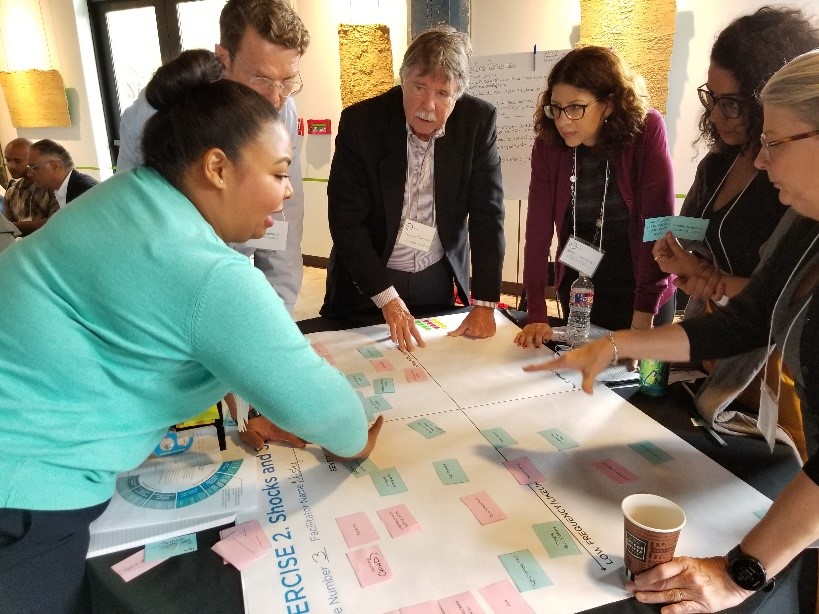
While the Planning & Development Department has many important initiatives, we’d like to highlight five projects that are underway and shaping Houston’s future. These projects present an opportunity for citizens to become more engaged and neighborhoods to become more vibrant, resilient, walkable and bikeable!
Houston Heights Historic Districts Design Guidelines
The Planning & Development Department (P&D) plays a significant role in supporting and preserving Houston’s neighborhoods, and strengthening the community through civic engagement and plan development. P&D helps communities maintain the character of their area through various neighborhood tools and programs, like Historic Preservation, Special Minimum Lot Size/Building Line, and Prohibited Yard Parking. These programs require applications initiated by the local community.
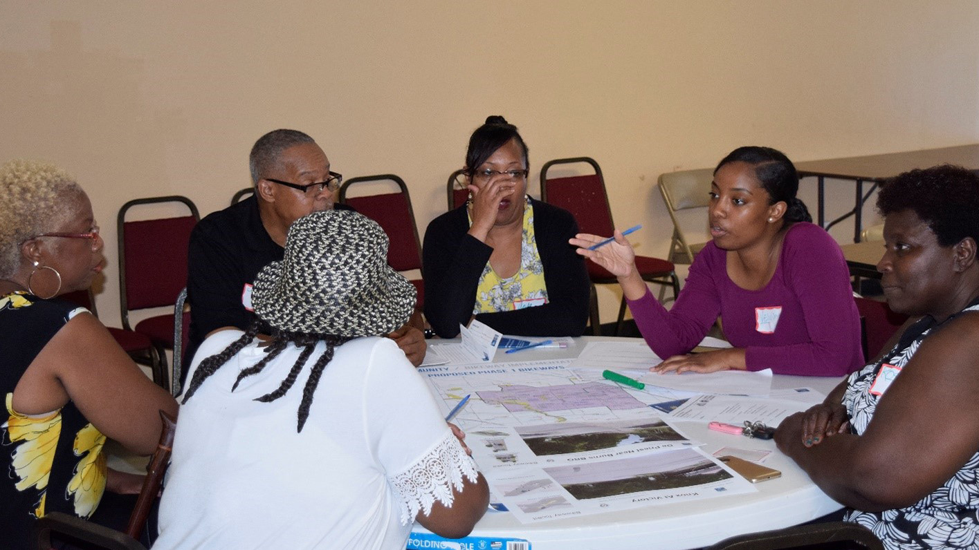
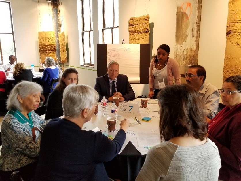
Planning Department staff at the Complete Communities kick-off
In 2017, the Department was charged with leading the Complete Communities initiative, Mayor Sylvester Turner’s signature program for improving quality of life in areas that are not thriving at a level enjoyed by other Houston neighborhoods.
![]() Mayor Turner announced the beginning of this new initiative on April 17, 2017.
Complete Communities
is about improving neighborhoods so that all of Houston’s residents and business
owners can have access to quality services and amenities. The Mayor selected five pilot neighborhoods for
the program: Acres Home, Gulfton, Near Northside, Second Ward and Third Ward. The objective is to improve these
communities while retaining affordable housing options, so that existing residents can stay in their neighborhood.
The public engagement culminated in one Action Plan in each community. The action plans outline the goals, projects,
and more and can be found at https://www.houstontx.gov/completecommunities.
Mayor Turner announced the beginning of this new initiative on April 17, 2017.
Complete Communities
is about improving neighborhoods so that all of Houston’s residents and business
owners can have access to quality services and amenities. The Mayor selected five pilot neighborhoods for
the program: Acres Home, Gulfton, Near Northside, Second Ward and Third Ward. The objective is to improve these
communities while retaining affordable housing options, so that existing residents can stay in their neighborhood.
The public engagement culminated in one Action Plan in each community. The action plans outline the goals, projects,
and more and can be found at https://www.houstontx.gov/completecommunities.
 City Council Resolution
In support of each of the five action plans, Houston City Council passed a
resolution supporting the five Complete Communities Action Plans on August 29,
2018. This Council resolution of the Mayor's signature program can help communicate
City support to future funders, philanthropists and grantors.
Office of Complete Communities Created
The Mayor's Office established an Office of Complete Communities to facilitate
implementation of the community action plans. With support of the Houston Endowment,
two full-time staff will ensure projects are implemented, funded, and managed efficiently.
The staff will develop strong collaborative relationships with City of Houston departments,
other governmental agencies and officials, private donors, and non-profit organizations key to project implementation.
Major Donors
The United Arab Emirates (UAE) Consul General in Houston, presented by Saeed Al Mehairi, granted $6.5 million
to the Greater Houston Community Foundation to help with Hurricane Harvey recovery efforts in the Houston area.
Part of this funding will directly support two Complete Community projects - Flores Neighborhood Library located
in Second Ward and Avenue Training and Education Center located in Near Northside.
Complete Communities University
To support each Complete Community as they work to implement and
execute their action plans, a training program was developed to support
their activities - Complete Communities University.
Classes were designed to strengthen the existing skills
of community leaders as they implement goals, actions and
project aspirations laid out in the plans. The workshop was held on
October 13, 2018.
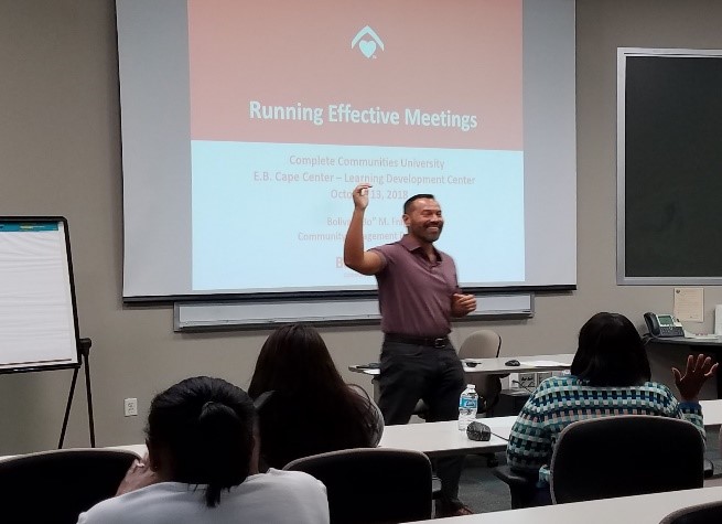
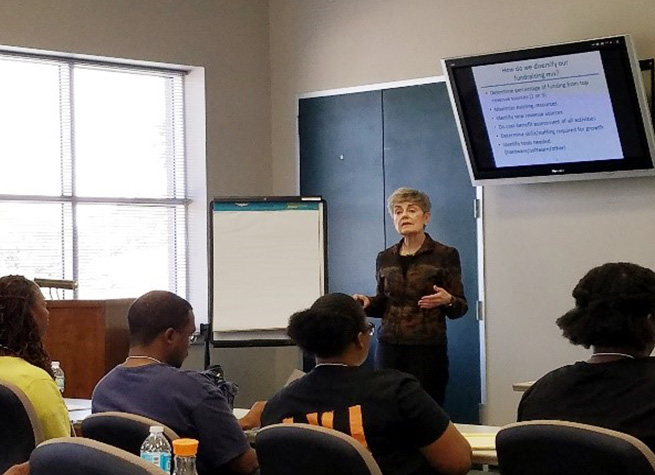
Workshop sessions covered several topics, including Running Effective Meetings and Fundraising
Prohibited Yard Parking Program
 Another tool available to
communities is the Prohibited Yard Parking Program(PYP),
which allows property owners to establish an area where the parking
of vehicles, , on front or side yards of single-family residential properties, is prohibited. In 2018,
the Planning & Development Department processed four PYP applications through City Council. There were 199 designated PYP areas in Houston as of December 31, 2018.
Another tool available to
communities is the Prohibited Yard Parking Program(PYP),
which allows property owners to establish an area where the parking
of vehicles, , on front or side yards of single-family residential properties, is prohibited. In 2018,
the Planning & Development Department processed four PYP applications through City Council. There were 199 designated PYP areas in Houston as of December 31, 2018.

Special Minimum Lot Size/Building Line Program
 The Special Minimum Lot Size Program establishes a minimum square
footage of lots within a specific area. This opt-in protection helps single-family neighborhoods maintain their existing lot size character. The Special
Minimum Building Line works similarly by establishing a minimum building setback to which any future development must adhere. In 2018, the Department processed
50 applications for these programs - 41 Special Minimum Lot Size Blocks, 7 Special Minimum Lot Size Areas, and 2 Special Minimum Building Line Blocks. As of December 31,
2018, the total number of protected properties for the Minium Lot Size and Minimum Building Line Program is 19,461 and 3,230 respectively.
The Special Minimum Lot Size Program establishes a minimum square
footage of lots within a specific area. This opt-in protection helps single-family neighborhoods maintain their existing lot size character. The Special
Minimum Building Line works similarly by establishing a minimum building setback to which any future development must adhere. In 2018, the Department processed
50 applications for these programs - 41 Special Minimum Lot Size Blocks, 7 Special Minimum Lot Size Areas, and 2 Special Minimum Building Line Blocks. As of December 31,
2018, the total number of protected properties for the Minium Lot Size and Minimum Building Line Program is 19,461 and 3,230 respectively.


Houston’s history is kept alive through its historical structures and neighborhoods. The Planning & Development Department and the Houston Archaeological and Historical Commission (HAHC) are stewards to Houston’s historical heritage through the City’s Historic Preservation Office, which governs the City’s 22 historic districts, 292 landmarks, and 156 protected landmarks. This year, the HAHC sent 6 new Protected Landmarks and 2 new Landmarks to City Council for approval. Any new construction, demolition, or alterations to structures in historic districts and historic landmarks require a Certificate of Appropriateness (COA). Statistics on the approval rates of COAs over the last five years are shown below.

2018 Approval Rates
2018 Review

Historic District 2018 Map
Section 106 and Environmental Reviews
As part of the City’s Certified Local Government responsibilities, the Historic Preservation Office reviews projects that have potential impacts to historic resources within the city limits. In 2018, the Office logged and/or commented on 82 projects. These projects mostly involved cell towers, Harris County Flood Control projects, and the North Houston Highway Improvement Project.
Heights Historic Districts Design Guidelines
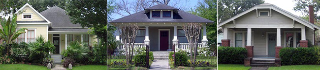
The City of Houston currently has 22 historic districts, and its Historic Preservation Ordinance is written broadly to apply to all of them. The HAHC directed Historic Preservation staff to develop design guidelines for the three Houston Heights historic districts. The design guidelines will be district-specific and provide predictability for applicants wanting to alter or construct structures within these districts. Since 2010, the City’s Historic Preservation ordinance has required the Planning & Development Department to develop design guidelines for new historic districts.
In 2017, design guidelines consultants Winter and Company completed a survey of property owners in the Houston Heights East, West, and South; Norhill; Woodland Heights; and Freeland Districts. The first set of design guidelines to move forward is for the three Houston Heights Districts (South, East, and West).
In June 2018, the HAHC approved the draft of the Houston Heights Historic District Design Guidelines (as amended) and sent the document to City Council for approval. City Council approved the Design Guidelines on July 24, 2018. After a several months long implementation period, the new Design Guidelines went into effect for the November 2018 HAHC.
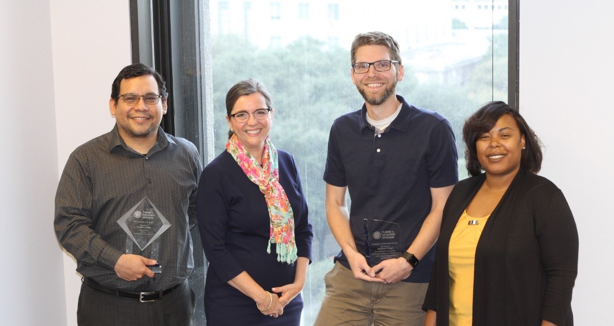
Historic Preservation Team
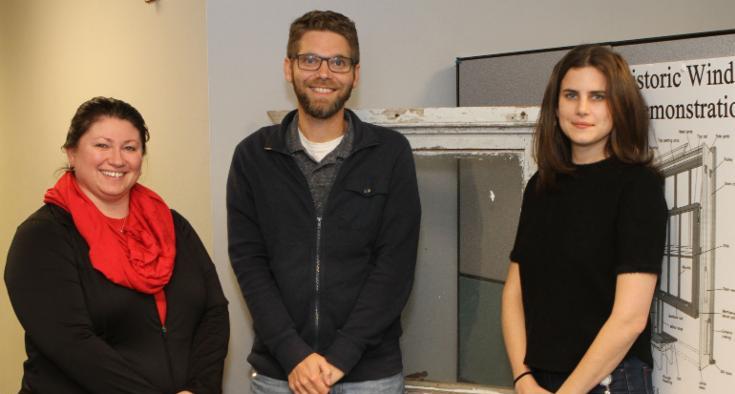
Left to right: Cari Foster, Interim Historic Preservation Officer Matthew Kriegl, and Sarah Fanelli.
Historic Preservation Tracker
The new Historic Preservation Application Tracker went live on July 30, 2018. All Certificate of Appropriateness (COA) Applications must be submitted through the Historic Preservation Tracker online.
HAHC Historic Highlights
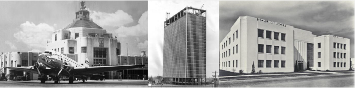
Left to right: Houston Municipal Airport Terminal, 500 Jefferson, and Schlumberger Well Surveying Corp.
Support letter submitted for the continued preservation of the Harris County Domed Stadium (Astrodome) and the Kirby Mansion
Recommended three properties be placed on the National Register of Historic Places:
2018 Houston Archaeological and Historical Commission
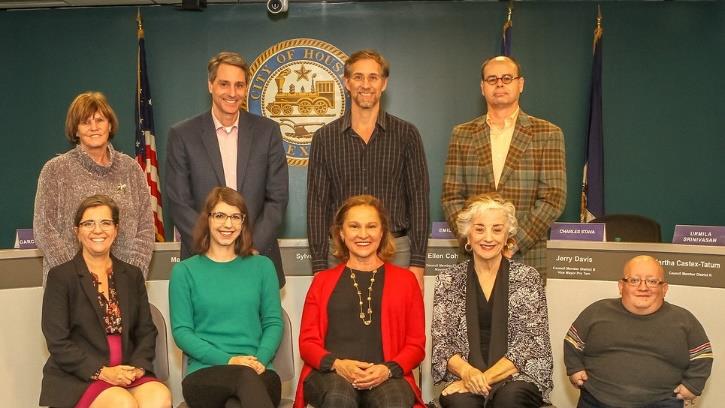
Back row (left to right): Sue Lovell, John Cosgrove, Ben Koush and Charles Stava. Front row (left to right): P&D Interim Director Margaret Wallace Brown, Emily Ardoin-Vice Chair, Minnette Boesel-Chair, Ann Collum, and Jorge Garcia-Herreros.
Historic Preservation Appeals Board
The Historic Preservation Appeals Board is a 5-member board that considers appeals of decisions of the Houston Archaeological and Historical Commission (HAHC). The board meets on an as-needed basis. In 2018, the board overturned two HAHC decisions.
Developing Our Growing City
The city’s growth and redevelopment are supported by the approval of subdivision plats and replats in accordance with the City’s land development ordinance, Chapter 42. P&D staff reviews development submittals inside the 669 square miles of the city and the 1,171 square mile extra-territorial jurisdiction (ETJ) for compliance with Chapter 42. Within the city limits, staff regulates development by applying other ordinances such as off-street parking (Chapter 26) and trees and shrubs (Chapter 33), as applicable. Development regulations with unique considerations such as hotel/motels, hazardous material enterprises, Certificates of Compliance, and cellular towers are a part of the Department’s responsibilities. The Department makes recommendations on many of these applications to the Planning Commission and Tower Commission.
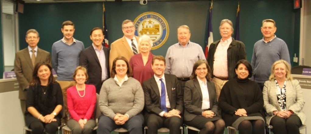
Planning Commission
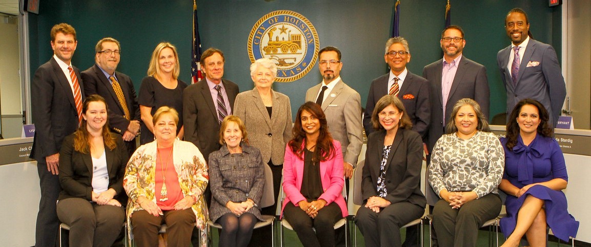
Back row (left to right): Bill Baldwin, Michael Kramer, Megan Sigler, Paul Nelson, Martha Stein-Chair, Sonny Garza- Vice Chair, Zafar Tahir, Ian Rosenberg and Antoine Bryant. Front row (left to right): Maggie Dalton, Lisa Clark, Susan Alleman, Meera Victor, Linda Porras-Pirtle, Lydia Mares, and Christina Morales
Tower Commission
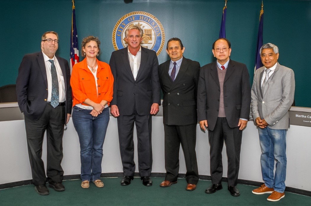
Left to right: P&D Assistant Director Michael Kramer, Christy B. Smidt, Rob Todd-Chair, Antonio Salinas, Dr. Shin-Shem Steven Pei, Ignacio Osorio, and John R. Melcher (not pictured)
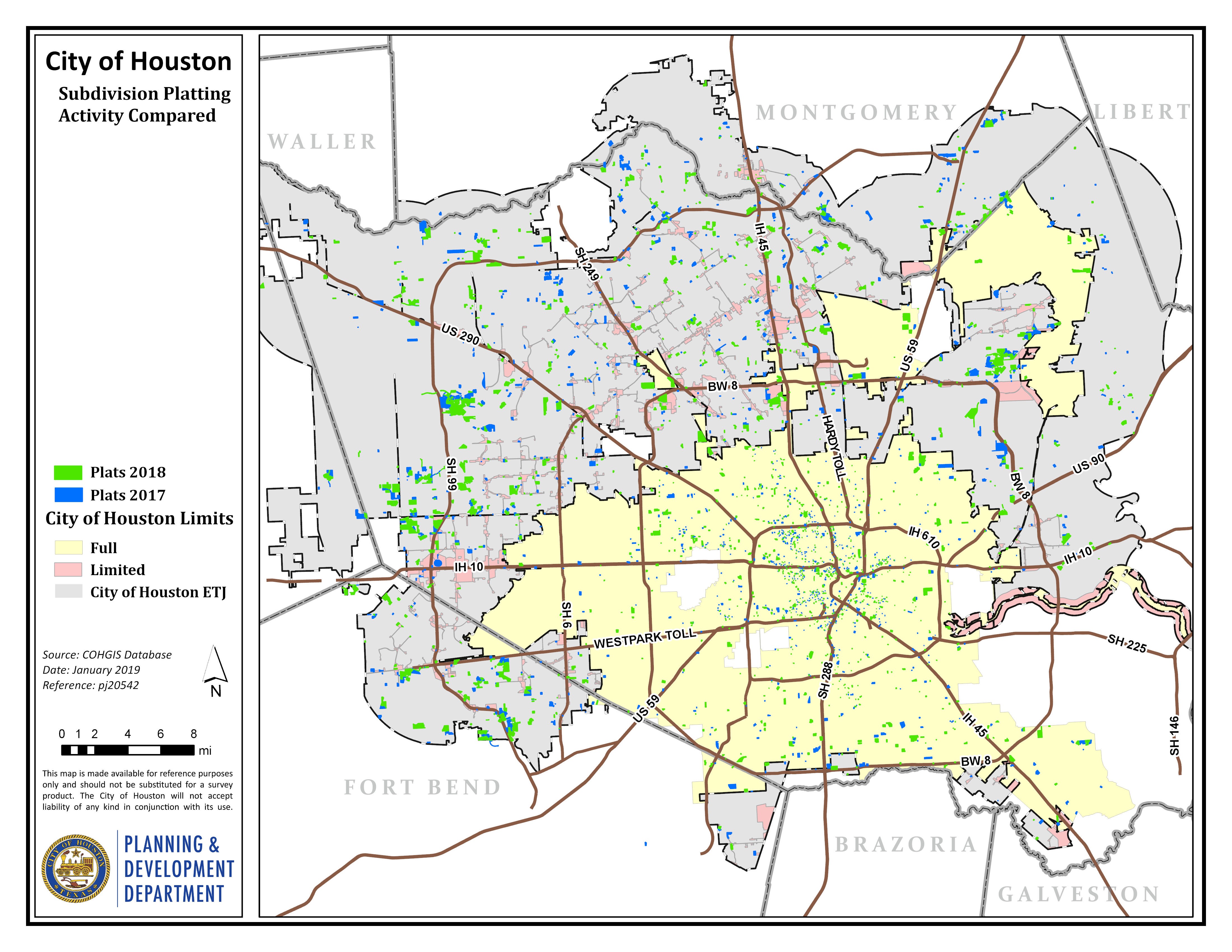
Plats and Plans
In 2018, the Planning Department saw a slight increase in the number of subdivision plat applications submitted; however, there was a decrease in the number of subdivision plats recorded. The total number of commercial and residential plans reviewed increased significantly since 2016.
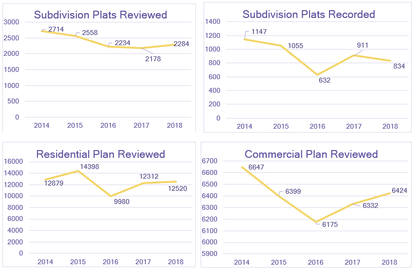
The map below shows the location of proposed development during 2017 and 2018. As you can see, a significant amount of platting of large parcels occurred along the Grand Parkway in Southwest, West and North Houston. Significant platting of smaller properties occurred throughout the city as well.
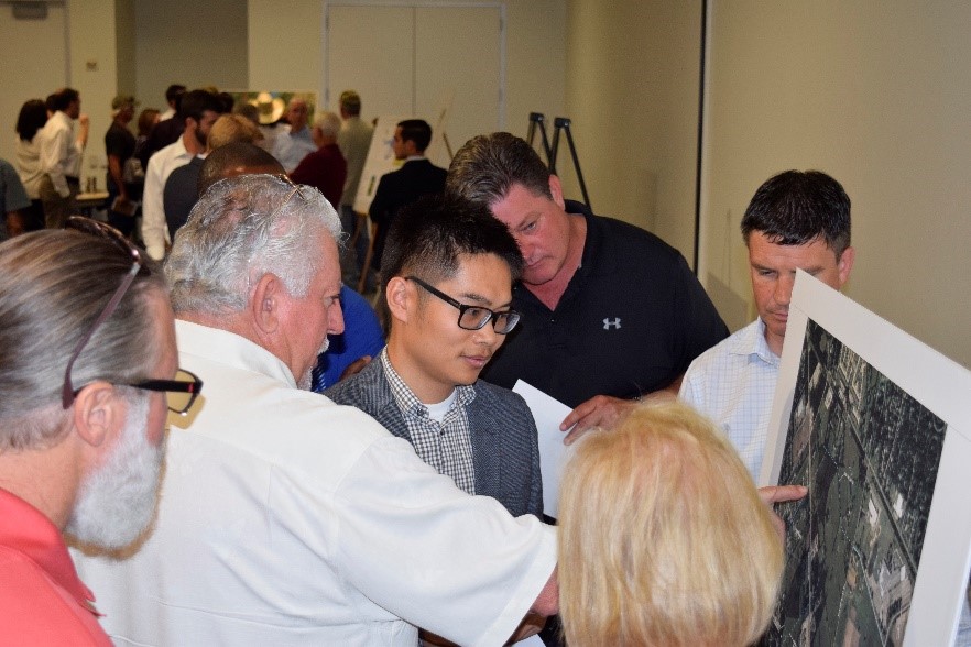
Customer Service
 Annual PSEFI meeting hosted by P&D’s Development Services team and Landtech, Inc.
In 2018, the Department consistently met its goal of reviewing 90% of commercial plans in five business days and 90% of residential plans in three business days. P&D aims to provide a high level of customer service and uses metrics to ensure service goals are achieved. The following graphic demonstrates the high service levels achieved in 2018 by the Houston Permitting Center team with only two months that dropped to 89% and 88%.


The Houston Planning Commission launched the Walkable Places Project in 2017. The project will develop approaches to promote walkable development that are more context sensitive. Today’s development code encourages a suburban style of development, which is not appropriate for walkable urban areas. Some of the characteristics of a walkable place include reduced building setbacks, pedestrian friendly building elements, wider sidewalks and unique parking arrangements.
In 2018, the Walkable Places Committee initiated public outreach in three Walkable Place Pilot Areas to test the context sensitive approach proposed. The three Walkable Place Pilot Areas are Midtown, Emancipation Avenue in Third Ward, and Hogan/ Lorraine Street in Near Northside. The committee also proposed Transit Corridor Ordinance amendments to promote transit-oriented development and encourage multi-modal transportation adjacent to the transit
Walkable Places Committee
Back row (left to right): Ron Lindsey, James Llamas, George Levan, Truman Edminster, Marty Stein, Greg LeGrande, Michael Huffmaster, and Clark Martinson. Front row (left to right): Cynthia Reyes-Revilla, Susan Alleman, Isabel Longoria, Bill Baldwin, P&D Interim Director Margaret Wallace Brown, Veronica Chapa Gorczynski, and Kim Mickelson.
Market Based Parking
 n 2018, the Planning Department initiated a proposal to expand the boundaries of the current parking rules in Downtown, known as the Central Business
District, to include a greater area in the Midtown and East Downtown areas. The new boundaries
will be a benefit for new businesses to provide parking based on their individual needs. The proposal is anticipated to go to City Council in 2019.
n 2018, the Planning Department initiated a proposal to expand the boundaries of the current parking rules in Downtown, known as the Central Business
District, to include a greater area in the Midtown and East Downtown areas. The new boundaries
will be a benefit for new businesses to provide parking based on their individual needs. The proposal is anticipated to go to City Council in 2019.
Limited/General Purpose Annexations
The Department helps manage boundary changes within the city
limits and in the City’s extraterritorial jurisdiction (ETJ).
These boundary changes are made necessary because of a growing
and changing region.
In 2018, Houston’s city limits grew through five limited purpose annexationsthat accompanied strategic partnership agreements with area utility districts. The City also disannexed one limited purpose area.
| District Name | Annexation Area (Square Miles) | Annexation Area (Acres) |
|---|---|---|
| Baybrook MUD 1 | 0.04 | 24.25 |
| El Dorado UD | 0.02 | 10.37 |
| FB FWSD 1 | 1.34 | 855.49 |
| FBC MUD 133 (Disannex) | -0.01 | -7.11 |
| HFBC MUD 5 | 0.02 | 9.88 |
| Southern Montgomery County MUD | 0.22 | 143.16 |
| TOTAL AREA | 1.62 | 1,036.04 |

The Department maintains the City’s core Geographic Information System (GIS) and is the repository for data pertaining to streets, public facilities and services, special districts, population demographics, and housing. It also collects and uses information from private entities and local, state and federal public agencies to provide street maps, aerial imagery and tabulated data for all aspects of the City. The ability to analyze and show data by specific geographic areas provides both citizens and the City officials a powerful tool to learn about locations of interest. This data is displayed on My City, the City’s primary GIS site. There are three teams of GIS professionals in the Planning & Development Department:
Addressing
The GIS Addressing Team maintains the City’s addressing database, street network, and maintains the various GIS municipal boundaries.
This group also verifies and assigns all new addresses for the City. Notable Addressing activities for 2018 included:
Houston Emergency Center
The GIS Houston Emergency Center (HEC) Team handles data related to Fire,
Police, and the 911 call floor. Notable HEC activities for 2018 included:
Mapping and Analysis
The GIS Mapping and Analysis Team creates the maps and graphics for the City to assist in making informed decisions.
Additionally, this team provides GIS training classes for all City departments. Notable Mapping and Analysis activities for 2018 included:
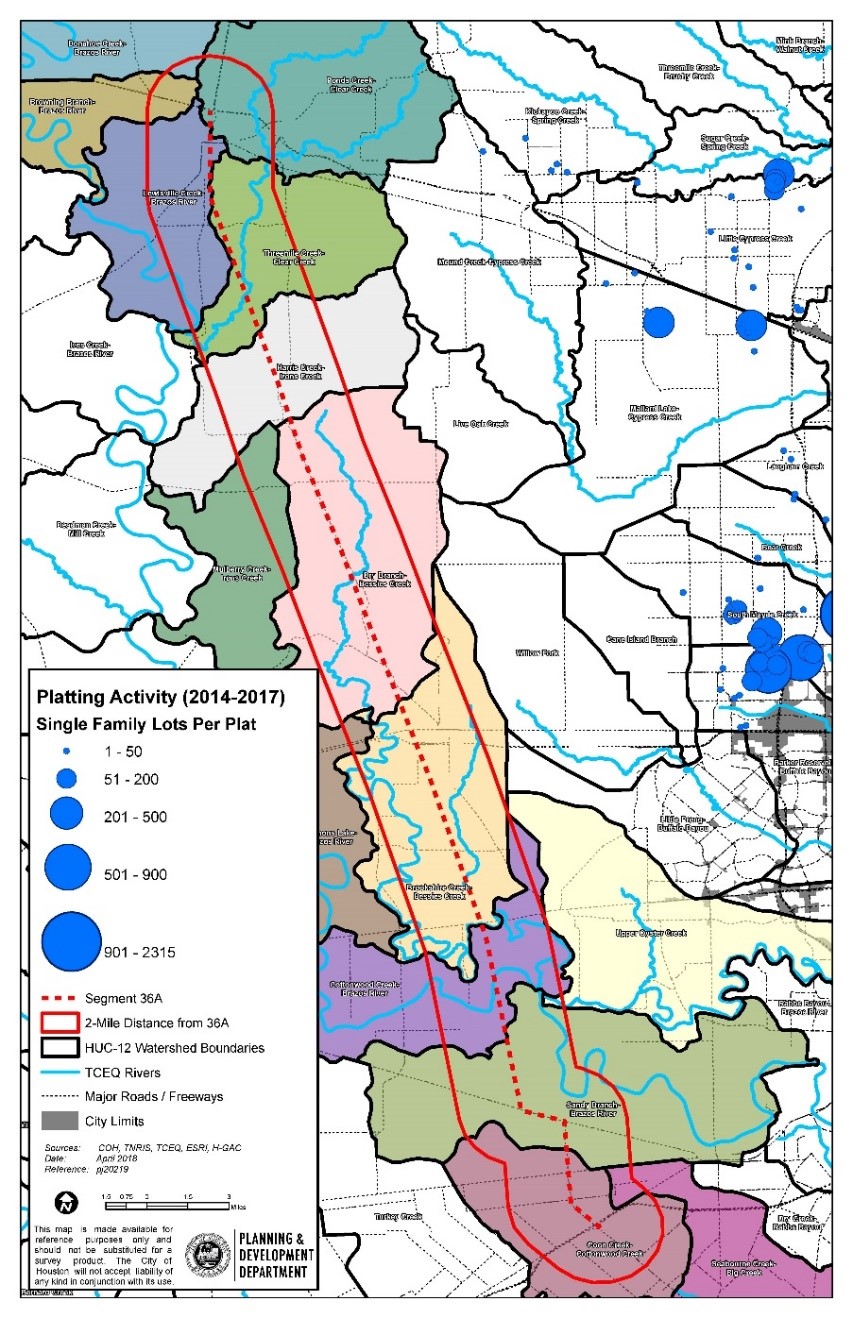
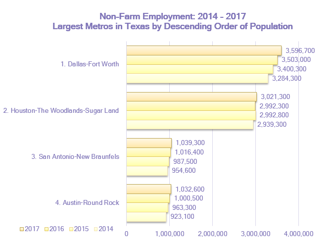
Platting Activity 2014 - 2017
 Geographic Information Officer Larry Nierth’s work on “Visualizing Property Value Cross Sections”, was published July 2018 in the Esri Map Book, Volume 33.
Visualizing Property Value Cross Section
In Houston, it is not unusual to see dramatic swings in property values when crossing a
freeway (or sometimes a major road). Visualizing property value variations can be done in many ways.
The idea was to use the raster values themselves to physically create a cross sectional chart. What if
the map and the chart were synonymous depending purely on the viewer’s perspective? These 2-dimensional
locations were used to create a property increase or decrease curve for each cross section. We examined property
values at a 1-mile-extent on either side of US Highway 290. This map enables you to observe and measure the change
in property value densities as you traverse cross sections of 1 mile on either side of the freeway.
~ Larry Nierth

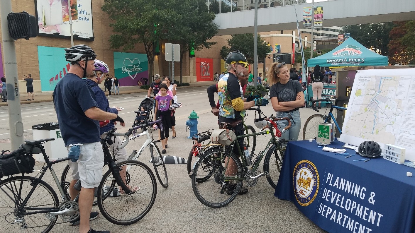
Leading the City’s systems-level transportation planning
System-level transportation planning includes management of the City’s Complete Streets and Transportation Plan, Major Thoroughfare & Freeway Plan, Bicycle Master Plan,
local area studies, and external transportation funding efforts. The Department also supports other departments, including Houston Public Works, as projects are developed
at the corridor level for capital improvements. In this way, the City sustains a seamless process for mobility improvements from planning through implementation.
Complete Streets and Transportation Plan Annual Report
In 2013, then-Mayor Annise Parker issued an Executive Order (E.O.) to develop a Houston Complete Streets
and Transportation Plan (HCSTP) for the City of Houston. This Plan is meant to provide public streets that are safe,
accessible, and convenient for use by motorists, public transit riders, pedestrians, bicyclists, and people of all ages and abilities.
P&D and Houston Public Works are working in partnership to implement the Plan. The Plan requires the completion and update of several component
plans, including the Major Thoroughfare & Freeway Plan, the Houston Bike Plan, and a Regional Transit Plan led by METRO. An Annual Report is required
by the Complete Streets E.O. to provide the Mayor an update on implementation of the HCSTP. The Report reviews work completed in the past year, documents
measurements of success, and lays out next steps for the upcoming year and beyond. The year in review report for 2018 is under development. To view the 2017
report, click here.
Major Thoroughfare & Freeway Plan
 P&D is responsible for maintaining the City’s Major Thoroughfare & Freeway Plan (MTFP).
The MTFP identifies the required right-of-way and street hierarchy designation (local, collector, thoroughfare, or transit corridor) for each
major street in Houston. The Department further incorporated the context-sensitive approach identified in the E.O. into the City’s annual process
for amending MTFP. In 2018, P&D administered 91- amendments to the MTFP, 20 of which were within the City limits, with the remainder in the City’s
extraterritorial jurisdiction (ETJ). These amendments were developed using the complete streets philosophy identified in the E.O.
P&D is responsible for maintaining the City’s Major Thoroughfare & Freeway Plan (MTFP).
The MTFP identifies the required right-of-way and street hierarchy designation (local, collector, thoroughfare, or transit corridor) for each
major street in Houston. The Department further incorporated the context-sensitive approach identified in the E.O. into the City’s annual process
for amending MTFP. In 2018, P&D administered 91- amendments to the MTFP, 20 of which were within the City limits, with the remainder in the City’s
extraterritorial jurisdiction (ETJ). These amendments were developed using the complete streets philosophy identified in the E.O.
Livable Center and Special District Studies
P&D works in partnership with Houston Public Works to represent the City of Houston in studies led by Houston-Galveston Area Council (H-GAC)
and other non-City entities. H-GAC's Livable Centers Program works with local communities to identify specific recommendations, such as pedestrian
and bicycle facilities, that foster the development of Livable Centers. Livable Centers, with concentrations of residential and employment land uses,
support more trips by foot, bicycle, transit, or carpool. The Westchase District Livable Centers Study and the Spring Branch Livable Centers Study were completed in 2018.
Houston BCycle Expansion
The Department sponsored an application in the 2015 Transportation Improvement Program Call for Projects and was awarded a $3.7 million
federal grant to expand the City’s Houston BCycle program. The expansion project, once completed, will add 97 bike stations and 767 bicycles
to the bike share network and two transport vehicles for bike share operations. Prior to the grant award, the bike share network had consisted
of 33 bike stations and 225 bicycles. Program operator Houston Bike Share is the local match sponsor of the application and is overseeing implementation of the new stations.
: Cougar Village, TMC Fannin & Ross Sterling, and TSU Rec & Wellness Center") Bike stations (left to right): Cougar Village, TMC Fannin & Ross Sterling, and TSU Rec & Wellness Center
Bike stations (left to right): Cougar Village, TMC Fannin & Ross Sterling, and TSU Rec & Wellness Center
Installation began in January 2017 with 18 new stations added throughout Downtown, Heights, Third Ward, Greater East End, Near Northside, Montrose, Museum District and Hermann Park, Houston Community College-Central and Rice University. In 2018, another 33 stations were added in the Texas Medical Center, Rice Village, Washington Corridor, and Midtown area, and at University of Houston and Texas Southern University campuses. Future bike stations planned include University of Houston-Downtown, Hermann Park, Inner Loop Northeast, Inner Loop Southwest, EaDO, Heights, and other surrounding neighborhoods.
Houston Bike Plan
![]() The Houston Bike Plan identifies projects that will create a City-wide bicycle network to serve a broad spectrum of people who bike at all skill levels,
provide more transportation choices, and build on efforts such as the Bayou Greenways Initiative to create a well-connected City-wide bicycle system of both on and off-street facilities.
The Houston Bike Plan identifies projects that will create a City-wide bicycle network to serve a broad spectrum of people who bike at all skill levels,
provide more transportation choices, and build on efforts such as the Bayou Greenways Initiative to create a well-connected City-wide bicycle system of both on and off-street facilities.
Bicycle Advisory Committee
In April 2018, Mayor Turner established the Bicycle Advisory Committee (BAC) to advise the Planning Commission and Planning Director on cycling issues in Houston.
The Chair and Vice Chair of the BAC formed two subcommittees to focus on BAC priorities: education and infrastructure. The Infrastructure Subcommittee will address
topics related to selecting, designing and implementing the Bike Plan’s proposed network of bikeways. The Education Subcommittee will address educational programs
and tools needed to increase safety for vulnerable road users. The equitable distribution of new bike infrastructure and safety of vulnerable road users are core concerns of both subcommittees.
2018 Bicycle Advisory Committee
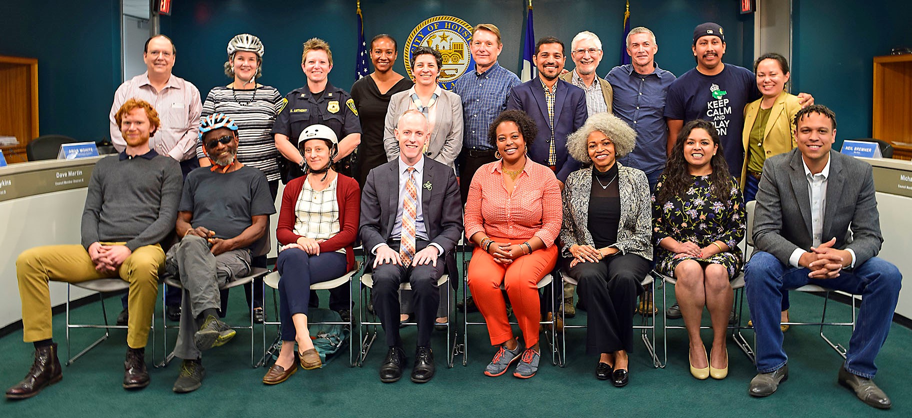
Back row (left to right) Mike Van Dusen, Robin Holzer, Captain Kristine Anthony, Oni Blair, Yuhayna Mahmud, Clark Martinson, Amar Mohite, John Long, Neil Bremner, Alejandro Perez, and Beth Martin. Front row (left to right) Ian Hlavacek, Veon McReynolds, Diane Dohm, Patrick Walsh, Maya Ford, Toloria Allen, Sandra Rodriguez, and Marlon Connely.
Implementation
Mayor Turner and Harris County Precinct One Commissioner Rodney Ellis formed a partnership to jump start implementation of
the Houston Bike Plan by constructing over $10 million of on-street bike lanes in one year’s time. The Planning & Development
Department worked with Houston Public Works and Precinct One to create a bike lane implementation program that
includes route identification, community engagement, feasibility analysis, design and construction, and community education.
P&D plays a significant role in the program by helping identify priority projects through engaging communities in discussions about mobility, whether to access destinations in the neighborhood or outside including work, school, church and shopping. P&D worked with Acres Home, Near Northside, Third Ward, Midtown, Washington Avenue, and Heights neighborhoods to identify neighborhood bike networks and significant corridors leading to destinations such as bayou trails, Downtown, and Hermann Park.
Bike to Work Day
The Transportation Planning team assumed responsibility for producing the City’s Bike to Work Day in May 2018, an annual event hosted at City Hall. Coinciding with national Bike Month, Bike to Work Day encourages people to explore bike routes in and around Downtown by participating in a group ride, learning bike safety tips, receiving complimentary bike tune-ups and enjoying food, music, and free giveaways. Bike to Work Day is a great way to help advance the Bike Plan goal of increasing ridership throughout the City.
Southeast Houston Mobility Study
 In the Spring of 2018, the Planning & Development Department kicked off the Southeast Mobility Plan, the City of Houston’s multimodal mobility study in the area bound by Interstate 610 to the north, State Highway 288 to the west, Sam Houston Toll Road to the south, and Interstate 45 and Galveston Road to the east. This steadily growing section of Houston includes Hobby Airport, a major freight rail corridor, single family neighborhoods, commercial areas and a range of industrial uses. The Plan, to be completed in 2019, will guide the City of Houston’s short, mid and long-term efforts to improve connectivity to destinations both in and outside of the study area. The plans multi-modal focus considers vehicular, transit, pedestrian, bicycle and freight travel. The plan will recommend changes to the Major Thoroughfare and Freeway plan and identify implementation projects and funding sources to improve mobility and access in Houston’s south-east area.
North Houston Highway Improvement Project
 The Texas Department of Transportation’s North Houston Highway Improvement Project (NHHIP) will create exciting opportunities for the city and its partners to reconnect neighborhoods, create memorable public spaces, and catalyze new development on the edges of Downtown as I-45 is rerouted to the east and I69 reconstructed. The vision is to create a central city that embraces its natural resources, provides pedestrian and bicycle access to surrounding neighborhoods, and reimagines how Downtown Houston is approached by automobiles at both highway and neighborhood levels. To help take advantage of this once in a generation opportunity, P&D engaged stakeholders in the Midtown area to create a vision for how the new, below grade highway would connect communities long divided by an elevated freeway. Staff hosted two stakeholder meetings and two public meetings to solicit ideas and request feedback on proposed improvements and continues to coordinate with stakeholders to turn the plan’s concepts into reality.
Vision Zero
The Planning & Development Department will develop Vision Zero plan for the City in late 2018. Vision Zero is a global initiative to eliminate deaths and severe injuries on all roadways. Vision Zero is not just a strategy but a complete change in how the City and its partners think about all aspects of mobility including street design and construction, enforcement of traffic laws, and public education. Much work is already being done by Houston Police Department, Houston Fire Department, Houston Public Works and other agencies to address safety issues. Vision Zero will bring these efforts under one unified umbrella and build on them. So far, P&D has formed a small, internal working group to prepare for a public launch of the initiative which will kick off an effort to create a Vision Zero plan to guide future efforts.
Who We Are?
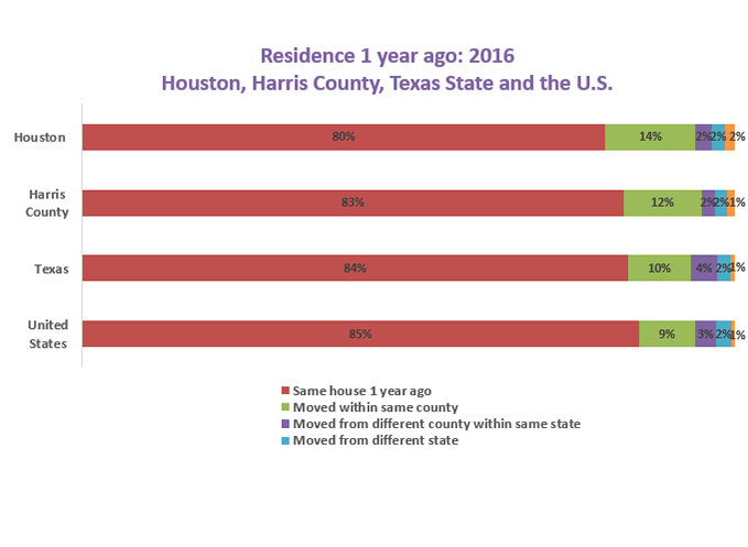
 Houston is a unique and vibrant city. As the nation’s fourth largest and most ethnically diverse city, Houston is estimated to have had a population of 2,328,419 as of July 1, 2018. At least 145 languages are spoken at home by our residents. Houston’s diversity is richly reflected in our food, music and culture.
The Planning & Development Department leads the City’s efforts to understand the demographics of our city and how Houston compares to its peers. The Department analyzes changes and trends in demographics; produces data and reports that inform and educate the community to make sound decisions for Houston’s future; and analyzes, compares and releases data/information related to population, permit activity, income, education, language, labor force, housing, and related characteristics on a bi-weekly basis. In 2018, the Department published a variety of charts and provided demographic and analytical support to various types of requests related to population, building permit and subdivision plat activities, language access, and other characteristics.
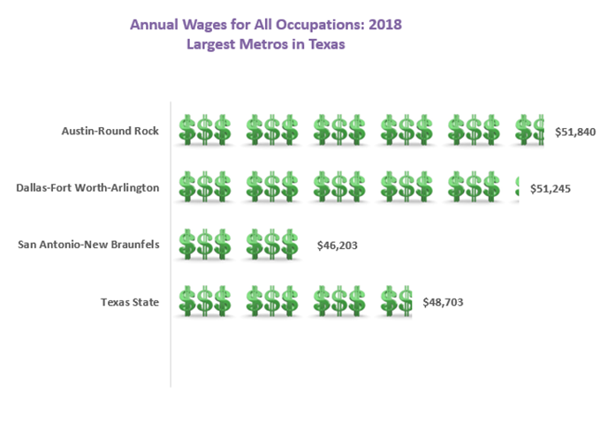
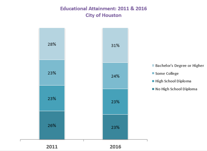
P&D periodically disseminates Census and related data for the city and region as depicted in the charts below.

Council District Profile Updates
P&D recently completed updates to all 11 Council Districts using the most current data available from the U.S. Census Bureau’s American Community Survey data release. These profiles contain interesting demographic data that is valuable to community organizations, stakeholders, and residents and helps inform city officials in the planning decision-making process.
Census 2020
The Planning & Development Department has completed adding new residential addresses (Local Update of Census Addresses) into the U.S. Census Bureau’s Master Address File so that Census 2020 forms will be mailed to all households within the City of Houston’s jurisdiction. The Department in partnership with the U.S. Census Bureau has initiated the Census 2020 initiatives.
Resilient Houston
 The 100 Resilient Cities Network, a $164 million global effort to build urban resiliency around the world, is now working in Houston! As a participating city, Houston anticipates that this program can help us better prepare for both chronic issues, such as homelessness and traffic, as well as a “one-off” events, such as a Hurricane Harvey weather incident or cyber-attack. An initial agenda setting workshop was held on November 8, 2018, to discuss Houston's resilience priorities and begin to develop a shared resilience agenda. The Office of Resilience will complement work conducted by the City's Flood Czar Office and other ongoing efforts across the city to achieve flood resilience in our region. For more details on this effort, read Mayor Sylvester Turner's press release or visit the 100 Resilient Cities website.
Workshop sessions covered several topics, including Running Effective Meetings and Fundraising
The Planning & Development Department is comprised of approximately 94 dedicated public servants who strive to make Houston a better place to live, work, and play.
Planning & Development Staff
History of the Planning Department
Department Awards & Recognition
Our Great Region Award
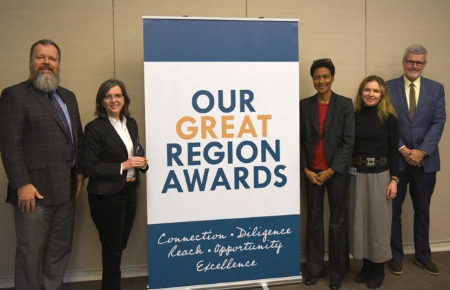
Margaret Wallace Brown, Lynn Henson and Jennifer Ostlind with the City of Houston are joined by Chuck Wemple and Jeff Taebel with Houston-Galveston Area Council
Complete Communities, one of Mayor Sylvester Turner’s major initiatives, was given the 2018 Our Great Region Award in the Reach category on January 11, 2019. The Our Great Region Awards recognize outstanding projects in the region that are advancing the goals and strategies identified in the Our Great Region 2040 plan. The Reach Award honors a project that demonstrates exemplary public participation. Completed in 2014 by 24 partner organizations, the Our Great Region 2040 plan is a high-level plan providing tools and strategies that could be used to make the 13-county region an even better place to live, work, and prosper by the year 2040. The plan examines six major topic areas (transportation, environment, economic development, resiliency, housing and healthy communities) and presents Big Ideas and strategies in each that the region can work together toward.
Keeping Houston’s History Alive
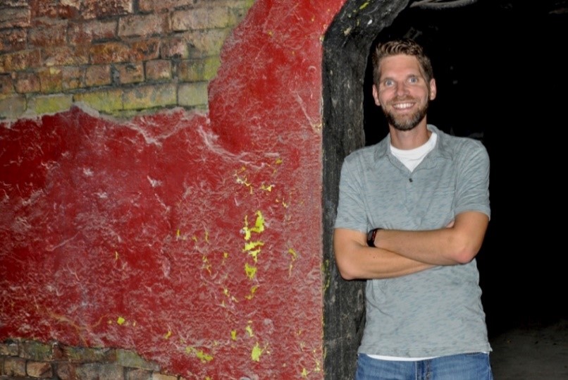 Historic Preservation Officer Matthew Kriegl was featured in October’s Houston’s City Savvy newsletter discussing the importance of Houston’s history and keeping it alive “A part of our job is to research and investigate the conditions of buildings — what they might have looked like through the years — so we can make recommendations about how to preserve the historic character of the building,” Kriegl said. “That’s the best part of the job, especially for big buildings downtown.”
That’s the best part of the job, especially for big buildings downtown.
- Matt Kriegl
Combined Municipal Campaign
 Each year City employees raise money for various charities through the Combined Municipal Campaign (CMC). In 2018, P&D raised a total of $ 7,772.94 for the CMC by hosting a variety of fundraising events, from selling breakfast tacos to a department costume contest. In honor of former Director Patrick Walsh and colleague Will Schoggins, all proceeds raised benefited the American Cancer Society and Bike Houston.
2018 P&D Excellence Service Awards
P&D recognizes employees for outstanding job performance and years of service to the City of Houston at an annual department service awards ceremony. The P&D Excellence Service Award honors individuals identified by their supervisors, peers, or colleagues in other departments, as having consistently excelled in their positions and demonstrated integrity and a strong commitment to the mission and values of the department in three areas of performance: Excellence in Customer Service Award, Exemplary Achievement or Performance and Outstanding Collaboration.
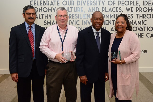
2018 P&D Award Recipients, pictured left to right: Abraham Zorrilla, Margaret Wallace Brown, Staff
25 Years
10 Years
5 Years